MapSource BlueChart - Inland Rivers - Maps
Model: Brand: Garmin
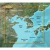
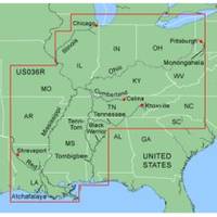
MapSource BlueChart is Garmin's exclusive marine cartography and was developed to provide you with mapping flexibility and options you've never had before. This line of cartography products is designed to provide interactive viewing of detailed nautical chart data, thereby providing navigators with innovative object-oriented cartography. These detailed electronic nautical charts look just like paper charts when displayed on your Garmin chartplotter. Features include shading between depth contours, spot soundings, navaids, port plans, wrecks, obstructions, inter-tidal zones, and more. BlueChart offers much larger coverage areas for half the price. MapSource BlueChart Inland Rivers provides detailed main channel coverage of the major rivers of the interior of the United States. It includes the Ohio, Illinois and the Atchafalaya Rivers in their entirety, and the Mississippi River from its junction with the Illinois above St. Louis, MO to the Delta. It also includes the Tennessee River from Knoxville, TN to the Ohio; the Cumberland River from Celina, TN to the Ohio; and the Red River from Shreveport, LA to the Mississippi. It also provides general coverage of the Gulf of Mexico from Port Arthur, TX to Biloxi, MS; and the southern portion of Lake Michigan from Waukegan, IL to South Haven, MI. « less
Product Specification
-
General
Product Type: MapsDistribution Media: Garmin Data CardFirst Seen On Google Shopping: January 2006 -
Compatibility Information
Designed For: Garmin GPSMap 172C, 176, 176C, 178C, 178C Sounder, 182, 182C, 188 Sounder, 188C Sounder, 196, 2006, 2006C, 2010, 2010C, 2106C, 2110C, 2206C, 2210C, 232, 238 Sounder, 276C, 292C, 296, 298C, 3006C, 3010c, 3205C, 3206C, 3210C, 376C, 392C, 396C, 492C, 498C -
Universal Product Identifiers
Part Numbers: 010-C0487-00, Inland RiversGTIN: 00753759057282
Related Products
-
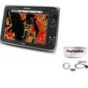
Package(e125 with USA Coastal Chart, 4KW 24 Inch Digital Radome & Radar Cable)
-
NA-C303 Furuno FP Format Shinnecock Bay Albe
-
BlueChart g2 Vision - Yellow Sea - Maps
-
Waterproof Charts 123F Coastal Miami Trolling Chart - FISH/DIVE
-
Kwik Tek Life Jacket Bag, 4 Adult
-
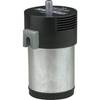
10102 Air Horn Compressor, 12VDC
-
Marine Navigation Workbook: Piloting and Celestial and Electronic Navigation [Book]
-
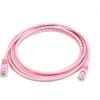
7ft 24AWG Cat5e 350MHz UTP Bare Copper Ethernet Network Cable - Pink
-
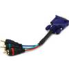
6025 6inch VGA to 3 RCA Component Video Cable (HD15 - 3-rca)
-
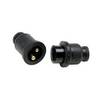
Molded Marine Connector 2 Conducter Seachoice 13801
-
Flush Mount Scupper Adapters, Flush Mount Scupper Adapter White th
-
C125 Multifunction Display w/US Coastal Charts Map