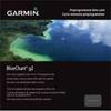
MapSource BlueChart - Southeast Florida - Maps
Model: Brand: Garmin
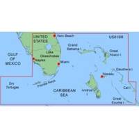
MapSource BlueChart is Garmin's exclusive marine cartography and was developed to provide you with mapping flexibility and options you've never had before. This line of cartography products is designed to provide interactive viewing of detailed nautical chart data, thereby providing navigators with innovative object-oriented cartography. These detailed electronic nautical charts look just like paper charts when displayed on your Garmin chartplotter. Features include shading between depth contours, spot soundings, navaids, port plans, wrecks, obstructions, inter-tidal zones, and more. BlueChart offers much larger coverage areas for half the price. MapSource BlueChart Southeast Florida covers Vero Beach south to include Lake Okeechobee, Florida Keys, Dry Tortugas, and covering the west coast of Florida north to Naples. Also covered all the Bahamas, Andros Island, Eleuthera Island, Cat Island, Great Exuma Island, Little Exuma Island, and Hog Cay. It features data from explorer charts for the Bahamas. « less
Product Specification
-
General
Product Type: MapsDistribution Media: microSD Memory CardFirst Seen On Google Shopping: January 2006 -
Compatibility Information
Designed For: Garmin eTrex Legend Cx, Vista Cx Garmin GPSMAP 60CSx, 60Cx, 76CSx, 76Cx -
Universal Product Identifiers
Part Numbers: 010-C0345-00, Southeast FloridaGTIN: 00753759055745
Related Products
-
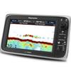
E97 Multifunction 9" Display with Sonar - No Charts E70022
-
CANNON 408560-1 21" Radar 4KW 24 rpm
-
Max Wide International cwidei
-
010-C0732-20 Bluechart G2 HXUS031RSouthwest Caribbean microSD
-
Canadian Charts - A, Alberni inlet/pt alberni/robbers Pa Canadian
-
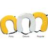
Cal June 1020 Horseshoe Buoy
-
Bronze Seacock, 1 1/2 Inch Adapter, Straight 0835008PLB
-
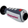
E70032 TH24 240 x 180 Thermal Marine Scope
-
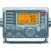
M504A 53 M504 Gray VHF - Rear Mic Version
-
Marina Micro LED Hub
-
SB10BL Switch Box 2 UNITS-1 Ducer Blue Connector
-
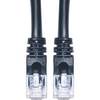
Cat6a Ethernet Cable | 15ft | Black | Network | 10 Gigabit