MapSource BlueChart - The Gulf and Red Sea - Maps
Model: Brand: Garmin
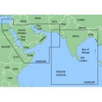
MapSource BlueChart is Garmin's exclusive marine cartography and was developed to provide you with mapping flexibility and options you've never had before. This line of cartography products is designed to provide interactive viewing of detailed nautical chart data, thereby providing navigators with innovative object-oriented cartography. These detailed electronic nautical charts look just like paper charts when displayed on your Garmin chartplotter. Features include shading between depth contours, spot soundings, navaids, port plans, wrecks, obstructions, inter-tidal zones, and more. BlueChart offers much larger coverage areas for half the price. MapSource BlueChart The Gulf and Red Sea covers of the Arabian Penninsula beginning at the Mediterranean Sea from Beirut to Alexandria. Coverage includes the Suez Canal, Gulf of Aqaba, and the Red Sea and Gulf of Aden in their entirety. Includes the Strait of Hormuz, Gulf of Oman, and coast of Somalia in the south. Coverage the of Kuwait, Saudi Arabia, Qatar, United Arab Emirates, along the southern coast of the Gulf and Iran along the northern coast. Coverage of Yemen and Oman coasts along the Indian Ocean to the Gulf of Oman, including Pakistan along the north coast, with general coverage of the Arabian Sea from Qamar Bay to the Delta of the Indus River. Included in this overall general coverage are numerous detailed charts covering areas such as Alexandria, Egy., Beirut, Leb., Al-Fuhaihil, Ad- Dammam, Bahrain, Ad-Dauha, and Abu Dhabi.Jiddah, Sau., Djibouti, Dji., and Aden, Yem. « less
Product Specification
-
General
Product Type: MapsDistribution Media: microSD Memory CardFirst Seen On Google Shopping: January 2006 -
Compatibility Information
Designed For: Garmin eTrex Legend Cx, Vista Cx Garmin GPSMAP 60CSx, 60Cx, 76CSx, 76Cx -
Universal Product Identifiers
Part Numbers: 010-C0415-00, The Gulf and Red SeaGTIN: 00753759056414
Related Products
-
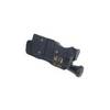
GPS receiver marine mount bracket
-
p3091 728 W/XDUCER
-
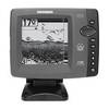
X59 DF - Fishfinder - portable - included transducer : Skimmer
-
BlueChart g2 Vision - Southwest Florida - Maps
-
The nautical chart [Book]
-
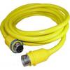
50PC50 50 Amp - 125VAC 50 Foot Cable Cord Set (Yellow)
-
USB 3.0 Micro Cable | 10ft | Type A | Micro Type B | Black
-
50ft 24AWG Cat6 550mhz UTP Ethernet Bare Copper Network Cable - Blue
-
Power Post Dual 2 x 3/8 in. Studs
-
329950-1 UHF Dbl Female Connector
-
EF2400iHC - 2400 watts/16.7 Amps Portable Inverter Generator - EF2400iHC
-
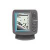
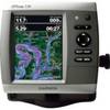
GPSMAP 536 - Marine Chartplotter - 5" color - 480 x 640