Gps/Chart Bracket Mount
-
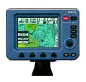
ColorMax 6 Color Chartplotter
SI-TEX ColorMax 6 LCD C-MAP MAX/NT+ Charting System offers all the latest features at an affordable price. Features GPS WAAS receiver, new high-speed processor, programmable Guardian Grounding Alarm and brilliant color LCD daylight viewable display to show outstanding clarity in bright sunlight on open boats.
-
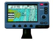
ColorMax Wide Color Chartplotter
SI-TEX ColorMax Wide LCD C-MAP MAX/NT+ Charting System features high-speed processor, GPS WAAS positioning, and programmable Guardian Grounding Alarm.
-
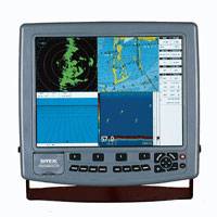
ColorMax 15 Chartplotter
Si-Tex ColorMax 15 Chartplotter LCD C-MAP MAX/NT+ Charting System features ultra-fast processor, GPS WAAS receiver, programmable Guardian™ Grounding Alarm, two video input ports for connecting cameras, second station capability and is expandable to an all-in-one GPS Charting System/Fishfinder/Radar with optional sensors.
-
-
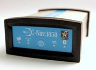
C-Nav3050 DGNSS Receiver
The C-Nav3050 integrated C-Nav/RTK Extend Receiver provides decimeter-level position accuracy, anywhere in the world, anytime. Powered by the new Sapphire GNSS Engine, the C-Nav3050 provides 66-channel tracking, including multi-constellation support for GPS, and GLONASS. It also provides patented interference rejection and anti-jamming capabilities. The C-Nav3050 is fully upgradeable, allowing users to go from a single-frequency receiver, to multi-frequency with a simple software upgrade. The flexibility of the C-Nav3050 will enable you to adapt to any application, and will give you the confidence to get the job done. 66-channel combined GPS/GNSS/L-band receiver provides decimeter, precise point positioning accuracy worldwide between 72°N and 72°S Multi-constellation support and tracks GPS, GLONASS, C-Nav, other SBAS (WAAS/EGNOS) signals, and accepts external RTCM input. Corrections over Internet. A choice of data rates make corrections via the internet affordable, and using Iridium delivery, reception at any Latitude is possible. Small and lightweight for fast and hassle-free setup. Low look angle L-Band antenna. Easily installed in series with the existing GNSS antenna, extends satellite delivered coverage area. Easily configured utilizing C-Setup , a free PC based software Easily monitored with intuitive front-panel LEDs, a C-NaviGator III Control & Display Unit, or C-Monitor, a C-Nav proprietary PC-based controller software.
-
620 GPSMAP
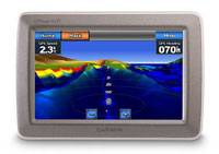
Garmin 620 GPSMAP two new Garmin 620 and 640 GPSMAP products offer elements of the GPSMAP 5000 series marine chartplotters combined with elements of the popular nüvi-series for use on the road – all in one easy-to-use device. Portable and powerful, the GPSMAP 620 and GPSMAP 640 feature a high-sensitivity GPS receiver and boast a large, super-bright 5.2” WVGA touchscreen display that reacts as users tap and drag through the intuitive user interface.
-
640 GPSMAP
Garmin 640 GPSMAP two new Garmin 620 and 640 GPSMAP products offer elements of the GPSMAP 5000 series marine chartplotters combined with elements of the popular nüvi-series for use on the road – all in one easy-to-use device. Portable and powerful, the GPSMAP 620 and GPSMAP 640 feature a high-sensitivity GPS receiver and boast a large, super-bright 5.2” WVGA touchscreen display that reacts as users tap and drag through the intuitive user interface.
-
541s GPSMAP Chartplotter with Transducer
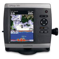
Garmin 541s GPSMAP is a compact chartplotter fishfinder sonar that features an ultra-bright 5” QVGA color display along with Garmin 541s improved high-speed digital design for increased map drawing and panning speeds. It’s ready to go with an easy-to-use interface and a built-in, satellite-enhanced basemap preloaded with all U.S. coastal areas, including Alaska and Hawaii as well as detailed charts for Bermuda. The GPSMAP 541 also accepts BlueChart® g2 Vision cards for added features and functionality such as high-resolution satellite imagery, 3D views and Auto Guidance technology.
-
541s GPSMAP Chartplotter NoTransducer
Garmin 541s GPSMAP is a compact chartplotter fishfinder sonar that features an ultra-bright 5” QVGA color display along with Garmin 541s improved high-speed digital design for increased map drawing and panning speeds. It’s ready to go with an easy-to-use interface and a built-in, satellite-enhanced basemap preloaded with all U.S. coastal areas, including Alaska and Hawaii as well as detailed charts for Bermuda. The GPSMAP 541 also accepts BlueChart® g2 Vision cards for added features and functionality such as high-resolution satellite imagery, 3D views and Auto Guidance technology.
-
6008 GPSMAP
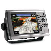
Garmin 6008 GPSMAP Unleash a new level of power across your helm. Garmin GPSMAP 6008 comes standard with a worldwide, satellite-enhanced basemap as well as video-quality resolution on an 8.4” VGA display.
-
c95 MFD Internal GPS
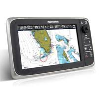
Raymarine c95 Network 9" MFD display widescreen LCD formats with LED backlighting that is both super bright yet energy saving – up to 40% less than previous generation multifunction displays! Raymarine c95 superior thermal management properties prevent darkening or screen blackouts at high temperatures. c95 bonded LCD screen eliminates condensation or contamination on the inside of the display, and maximises colour and contrast by preventing unwanted reflections.
-
c95 MFD Internal GPS US Charts
Raymarine c95 Network 9" MFD with US Coastal Charts display widescreen LCD formats with LED backlighting that is both super bright yet energy saving – up to 40% less than previous generation multifunction displays! Raymarine c95 superior thermal management properties prevent darkening or screen blackouts at high temperatures. c95 bonded LCD screen eliminates condensation or contamination on the inside of the display, and maximises colour and contrast by preventing unwanted reflections.
-
c95 MFD Internal GPS Inland Charts
Raymarine c95 Network 9" MFD with US Inland Charts display widescreen LCD formats with LED backlighting that is both super bright yet energy saving – up to 40% less than previous generation multifunction displays! Raymarine c95 superior thermal management properties prevent darkening or screen blackouts at high temperatures. c95 bonded LCD screen eliminates condensation or contamination on the inside of the display, and maximises colour and contrast by preventing unwanted reflections.
-
c125 MFD Internal GPS
Powerful Raymarine c125 Network 12" MFD display widescreen LCD formats with LED backlighting that is both super bright yet energy saving – up to 40% less than previous generation multifunction displays!
-
c125 MFD Internal GPS US Charts
Raymarine c125 Network 12" MFD with US Coastal Charts display widescreen LCD formats with LED backlighting that is both super bright yet energy saving – up to 40% less than previous generation multifunction displays! Raymarine c125 superior thermal management properties prevent darkening or screen blackouts at high temperatures. c125 bonded LCD screen eliminates condensation or contamination on the inside of the display, and maximises colour and contrast by preventing unwanted reflections.
-
c125 MFD Internal GPS Inland Charts
Raymarine c125 Network 12" MFD with US Inland Charts display widescreen LCD formats with LED backlighting that is both super bright yet energy saving – up to 40% less than previous generation multifunction displays! Raymarine c125 superior thermal management properties prevent darkening or screen blackouts at high temperatures. c125 bonded LCD screen eliminates condensation or contamination on the inside of the display, and maximises colour and contrast by preventing unwanted reflections.
-
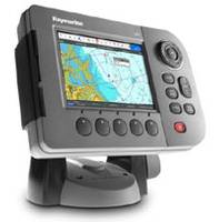
A50 Chartplotter
Raymarine A50 chartplotter compact 5” Chartplotter available with preloaded Navionics ready-to-navigate charts. Raymarine A50 step up Navionics Gold or Platinum charts. 3D and satellite photo map navigation using optional Navionics Platinum chart Built-in high sensitivity 12 channel GPS receiver with WAAS. Sunlight viewable high resolution VGA (640 x 480) for pixel perfect chart detail.
-
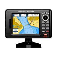
CP190i
Standard Horizon CP190i has award winning C-Map coastal charts built-in which cover USA, Canada, Bahamas, Carribean, Cuba and South America. CP190i details include: all Navaids icons on chart page, depth contours and soundings up to 66Ft, Graphical tide display / icons on chart and Marina icons and the list of services symbols.
-
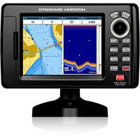
CPF190i
Standard Horizon CPF190i has award winning C-Map coastal charts built-in which cover USA, Canada, Bahamas, Carribean, Cuba and South America. CP190i details include: all Navaids icons on chart page, depth contours and soundings up to 66Ft, Graphical tide display / icons on chart and Marina icons and the list of services symbols.
-
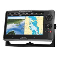
CPN1010i GPS
Standard Horizon CPN1010i GPS 10" CPN series will grant you the confidence you need to navigate safely to your destination and gives you something to do along the way. The CPN series plotters come with built in Wi-Fi, multimedia capabilities, USB and Bluetooth technology, Ethernet networking, XM Weather overlay, and more, all on an easy-to-use touch screen display.
-
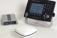
C-Nav1000 DGPS Receiver
The C-Nav1000 R4 Navigation system is a stand-alone DGPS sensor which includes a 12-channel GPS receiver and a control/display unit with a 6-inch sunlight readable VGA screen. The system accepts differential correction data from WAAS, EGNOS, MSAS and other satellite-based DGPS transmissions in addition to land-based IALA beacons. It is fully compliant with IMO and IEC specifications for shipboard GPS (Wheelmark and US Coast Guard compliant). The control and display panel has red, yellow and green "traffic lights" in accordance with IEC RAIM specifications. This visual indication allows for the user to monitor the integrity of the GPS solution in real time. The system can connect to existing or future SAAB AIS systems to ensure that the vessel operates in full compliance with all relevant regulations. The system, combined with the SAAB AIS configuration, will display and control navigation data and AIS information.
