010-C0730-10 Bluechart G2 HUS029RSouthern Bahamas Data Card
Model: 010-C0730-10 Brand: Garmin
Featuring data from explorere charts for the Bahamas! Detailed coverage from Eleuthera Island, Bahamas to the Dominican Republic, including the Bahamian islands of Great Exuma, Great Inagua, Mayaguana, and many others. Also includes detailed coverage of the Jamaican, Haitian, and Dominican coasts in their entirety, the easternmost quarter of Cuba, and the Turks and Caicos Islands. See your surroundings more clearly with BlueChart g2 data. With BlueChart g2, you'll get detailed marine cartography that provides convenient viewing of nautical content. BlueChart g2 allows you to see your vessel's precise, on-chart position in relation to naviads, coastal features, anchorages, obstructions, waterways, restricted areas and more. You will also have access to detailed mapping capabilities that include Safety Shading , Fishing Charts , smooth data transition between zoom levels, harmonious transition across chart borders, and reduction of chart discontinuities. « less
Product Specification
-
Universal Product Identifiers
Part Numbers: 010-C0730-10, 10469864, 35560, GAR010C073010GTIN: 00753759089313
Related Products
-
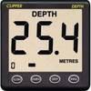
CL-D Depth Instrument with Thru Hull Transducer & Cover
-
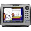
HDS-8 Insight USA w/o Ducer 140-39
-
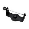
GPS receiver marine swivel mounting bracket
-
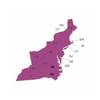
Max Lake - Region 2: East - C-Card NAM018
-
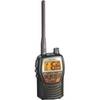
Genuine Cobra Ite-t50421-dbd1 Marine VHF Handheld Radio 10
-
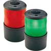
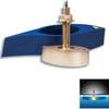
Base Mount All Round Navigation Lights Light, Green
-
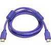
6ft 28AWG High Speed HDMI Cable w/Ferrite cores - Purple
-
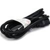
6ft 16AWG Power Cord Cable w/ 3 Conductor PC Power Connector Socket (C13/5-15P) - Black
-
6ft 32AWG Mini DisplayPort Male to Female Extension Cable - White
-
TNC-Cp/Gs-02 Connector for RG-8X Cable tncpgs
-
B260-6N 1kW Thru-Hull Transducer Navico 6-Pin Connector
-
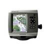
GPSMAP 441 - Marine GPS receiver - 4" color - 240 x 320