GPSMAP 530 - Marine GPS receiver - 4" color - 240 x 320
Model: 530 Brand: Garmin
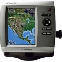
The slim-line, freshwater GPSMAP 530 flush-mounts easily in your boat and sports preloaded, detailed maps for U.S. inland lakes. The 530 also features a 5" QVGA display and simple, straightforward buttons and menus. You can add the optional BlueChart g2 Vision SD card for even more enhanced features. The 530 comes preloaded with detailed maps for U.S. inland lakes, including 5300 lakes with shoreline, depth contours, navaids, and more. Over 300 of these lakes are enhanced with extra Inland Lakes Vision features. For areas outside the U.S., the 530 has a worldwide basemap with satellite images in place of more traditional maps. The SD card slot makes it easy to add additional maps without connecting to a computer. And with just a few buttons and a simple, intuitive interface, the 530 makes navigating your way through the water easy. « less
Product Specification
-
General
Product Type: GPS receiverRecommended Use: MarineReceiver: 12 channelCard Reader: SD Memory CardInterface: NMEA 0183Included Software: MapSource BlueChart Inland Lakes: United StatesCompatible Software: BlueChart g2 VisionSBAS: WAASDGPS: DGPS readyAntenna: Built-inAccuracy: Position - 49 ft Velocity - 0.16 ft/sec Position - 10 ft ( with WAAS )Update Rate: 1/secondFeatures: Depth sounder, alarm, 2D / 3D map perspectiveFirst Seen On Google Shopping: May 2007 -
Display
Type: LCD - colorDiagonal Size: 4"Resolution: 240 x 320Features: Adjustable brightness -
Acquisition Times
Warm: 15 secCold: 45 sec -
Navigation
Waypoints: 1500Tracks: 20Tracklog Points: 10000Routes: 20Trip Computer: Sunrise/sunset times, sun/moon positions -
Connections
Interfaces: Antenna -
Miscellaneous
Design Features: Rugged caseProtection: WaterproofWaterproof Standard: IPX7Included Accessories: Protective cover, mounting bracket, power/data cable -
Dimensions & Weight
Width: 5.9 inDepth: 2.9 inHeight: 6.4 inWeight: 1.8 lbs -
Environmental Parameters
Min Operating Temperature: 5 °FMax Operating Temperature: 131 °F -
Universal Product Identifiers
Part Numbers: 010-00612-00, 530GTIN: 00753759065942
Related Products
-
Fishing Hot Spots E112 Pro USA Chart f/Lowrance
-
Inc MSD/PREM-N6 Map, HotMaps Premium North
-
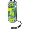
SARLink 406 MHz GPS Personal Locator Beacon 2883
-
Cat6a Ethernet Cable | 5ft | Gray | Network | 10 Gigabit
-
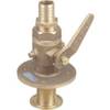
0835006PLB Seacock w/Straight TP 1in
-
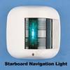
42recessed Stbrd Sidelight 12v/25w
-
Bulk cable - Fiber optic 1000 ft
-
2742 35ft 24AWG CL2 Standard HDMI Cable - Black
-
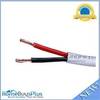
50ft 18AWG CL2 Rated 2-Conductor Loud Speaker Cable (for In-Wall Installation)
-
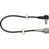
DA65H 3' Cell Adapter Cable
-
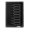
ACCY-IX Breaker Panel with Lights
-
Whisper 65' Guyed Tower Kit (Whi100/Whi200) (does Not Include Pipe & Anchors)