010-C0747-10 Bluechart G2 HAF001REastern Africa Data Card
Model: 010-C0747-10 Brand: Garmin
General coverage of the east coast of Africa from the Gulf of Tadjoura to the Bay of Maputo, including Mogadishu, Som., Mombasa, Ken., and Dar es Salaam, Tan. Also includes general coverage of the entire coast of Madagascar. Includes detailed coverage of Djibouti, Dji., Maputo, Moz., Mauritius, Reunion, and the Seychelles. See your surroundings more clearly with BlueChart g2 data. With BlueChart g2, you'll get detailed marine cartography that provides convenient viewing of nautical content. BlueChart g2 allows you to see your vessel's precise, on-chart position in relation to naviads, coastal features, anchorages, obstructions, waterways, restricted areas and more. You will also have access to detailed mapping capabilities that include Safety Shading , Fishing Charts , smooth data transition between zoom levels, harmonious transition across chart borders, and reduction of chart discontinuities. « less
Product Specification
-
Universal Product Identifiers
Part Numbers: 010-C0747-10, 10804532, 35575GTIN: 00753759089634
Related Products
-
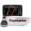
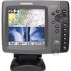
T70106 e7D 7" Multifunction Display w/Sonar, Internal G
-
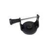
GPS receiver marine swivel mounting bracket
-
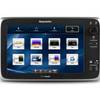
T70043 E97 Multifunction Display w/Sonar - European Charts
-
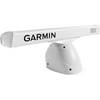
K10-00012-06 GMR 404 XHD 4KW Pedestal & 4ft Open Array
-
E125 Multifuntion Display - No Preloaded Charts Map
-
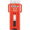
Firefly 3 Orange U Strobe
-
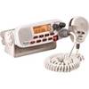
RADIO-FIX VHF Class-D DSC Wht
-
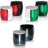
Marine Naviled Pro Port Navigation Light
-
Marine Navigation: Piloting [Book]
-
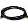
6ft RG6 (18AWG) 75OHM, Quad Shield, CL2 Coaxial Cable with F Type Connector - Black
-
700 Series 798ci SI Combo - Marine Chartplotter - 5" color - 640 x 640
-
500 Series 535 Portable - Fishfinder - portable - included transducer - single-beam