010-C0749-10 Bluechart G2 HAF003RWestern Africa Data Card
Model: 010-C0749-10 Brand: Garmin
General coverage of the west coast of Africa from El Aaraich, Mor. to Cape Cross, Nam., including Abidjan, C.I., Douala, Cam. and Luanda, Ang. Included in this overall general coverage are a number of detailed charts covering areas such as Casablanca, Mor., Dakar, Sen., and Lagos, Nig. Also includes general coverage of St. Helena Is., Ascension Is., and the Azores. Also includes detailed coverage of the Madeira Islands, Canary Islands, and Cape Verde Islands. See your surroundings more clearly with BlueChart g2 data. With BlueChart g2, you'll get detailed marine cartography that provides convenient viewing of nautical content. BlueChart g2 allows you to see your vessel's precise, on-chart position in relation to naviads, coastal features, anchorages, obstructions, waterways, restricted areas and more. You will also have access to detailed mapping capabilities that include Safety Shading , Fishing Charts , smooth data transition between zoom levels, harmonious transition across chart borders, and reduction of chart discontinuities. « less
Product Specification
-
Universal Product Identifiers
Part Numbers: 010-C0749-10, 10804573, 35579GTIN: 00753759089672
Related Products
-
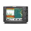
1158c High Definition External GPS & Fishfinder with Transom Mount Transducer 39688
-
FR8122 12.1 Inch 12KW 72 NM Radar with 4' Open Array Antenna
-
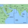
MapSource BlueChart - The Gulf and Red Sea - Maps
-
SD642P S Car-N Florida Plat+On M155Sd
-
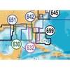
010-C0787-20 Bluechart G2 HXEU051RLista - Sognefjorden microSD
-
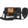
000-10213-001 RS25 VHF Radio
-
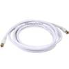
12ft RG6 (18AWG) 75OHM, Quad Shield, CL2 Coaxial Cable with F Type Connector - White
-
Patch cable - CAT 6 - RJ-45 - M - Unshielded twisted pair (UTP) 10 ft - Gray
-
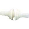
3878-3 Double-Ended Thru-Hull Connector
-
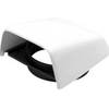
Marine Cowl Vent w/Hose Adapter f/4 BEC-C8
-
Products 45444 600 Watt Land Wind Turbine Power Generator wit
-
5ft 24AWG Cat6 550mhz UTP Ethernet Bare Copper Network Cable - Yellow