010-C0762-10 Bluechart G2 HEU003RGreat Britain Northeast
Model: 010-C0762-10 Brand: Garmin
Covers from the Isle of Lewis, Scotland to Bridlington Harbour, England, including Gairloch, the Shetland Islands, Edinburgh, and North Sea offshore charts. Also includes the Caledonian Canal, Loch Linnhe, and Loch Ness. See your surroundings more clearly with BlueChart g2 data. With BlueChart g2, you'll get detailed marine cartography that provides convenient viewing of nautical content. BlueChart g2 allows you to see your vessel's precise, on-chart position in relation to naviads, coastal features, anchorages, obstructions, waterways, restricted areas and more. You will also have access to detailed mapping capabilities that include Safety Shading , Fishing Charts , smooth data transition between zoom levels, harmonious transition across chart borders, and reduction of chart discontinuities. « less
Product Specification
-
Universal Product Identifiers
Part Numbers: 010-C0762-10, 10804805, 35597GTIN: 00753759091477
Related Products
-
Inked Photography Series Kick Drumhead 24 Inch Boat Props
-
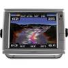
GPSMAP 7012 GPS Chart Plotter Mfd 11068541
-
Package(E90W, GPS Antenna, DSM300G Sounder, 4KW 18 Inch Digital Radome & Radar Cable )
-
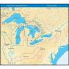
NT+ Wide Map, Lake Huron/Georgian Bay/North Channel NA-C104
-
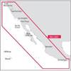
NA-C601 Acapulco, Mexico to Cape Flattery
-
SD699P N Bahamas Plat + on M155-Sd
-
010-C0732-20 Bluechart G2 HXUS031RSouthwest Caribbean microSD
-
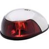
3820PF1 Light,Nav(Sold Pair Only)12Vss
-
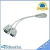
MP Rs232 Serial Mouse or Monitor Splitter Cable - 1DB9 Female to 2 DB9 Male 4640
-
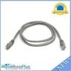
3ft 24AWG Cat5e 350MHz UTP Bare Copper Ethernet Network Cable - Gray
-
ZDIGUSBNMEA NMEA Adapter
-
SB-6BK Switch Box 2 Units 1 Transducer Black Connector