4123 La &Amp; Orange County Inshore
Model: 4123 Brand: Fish-n-Map
FISH-N-MAP UNDERWATER TOPOGRAPHY MAPSMade of waterproof, tear resistant plastic. Features include: underwater depth contours, fish locations, latitude and longitude for GPS, multiple freshwater lakes on one map, boat ramps, recreational facilities and much more.
Product Specification
-
Universal Product Identifiers
Part Number: 4123GTIN: 00761428041234
Related Products
-
Inc ETS035936 Computer Hardware
-
Package(C90W, RA1072HD 4KW 72 Inch HD Digital Open Array Radar & 15m Radar Cable)
-
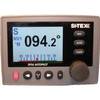
SP36-11 SP-36 Autopilot System
-
10ft 24AWG Cat6 550mhz UTP Ethernet Bare Copper Network Cable - White
-
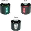
Series 43 LED Navigation Lights, Ser 43 White LED Nav Light Strbd
-
15ft USB 2.0 A Male to B Male 28/24AWG Cable (Gold Plated)
-
50ft Premier Series XLR Male to XLR Female 16AWG Cable (Gold Plated) [Microphone & Interconnect]
-
10ft 32AWG Mini DisplayPort to DisplayPort Cable - White
-
E02037 19� Ultra Bright Marine Display / G190
-
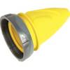
F30Cvl-Sy 30 Amp Connector (F) Cover Yel
-
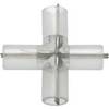
4-Way Connector for 3/8 Inch Rope Light - Imt-ilmdl-4way
-
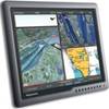
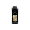
GPSMAP 78 - Marine, hiking GPS receiver - 2.6" color - 160 x 240