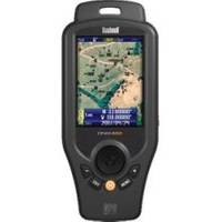
ONIX400 - Hiking GPS receiver - 3.5" color - 320 x 240
Model: ONIX400 Brand: Bushnell
This handheld GPS combines navigational aids, satellite photography and XM weather on a single screen. It shows you the perfect pinchpoint for this wind. And how you should dress for the day. NEXRAD weather data downlinked via XM Weather, layered over a georeferenced satellite map of your location keeps you prepared. It's all housed in a rubberized defensive armor built to XPX7 waterproof standards, with a high gain SIRF GPS receiver. In your palm. « less
Product Specification
-
General
Product Type: GPS receiverRecommended Use: HikingPreloaded Maps: North AmericaReceiver: 20 channelCard Reader: microSDInterface: USBSBAS: WAASFeatures: XM Satellite Radio support, XM weather supportFirst Seen On Google Shopping: October 2007 -
Display
Type: LCD - colorDiagonal Size: 3.5"Resolution: 320 x 240Display Illumination: Yes -
Navigation
Waypoints: 1000Tracks: 20Routes: 20 -
Connections
Interfaces: USB -
Battery
Type: Lithium ionRun Time (Up To): 32 hours -
Miscellaneous
Design Features: Rugged caseProtection: WaterproofWaterproof Standard: IPX7Included Accessories: 128 MB microSD Card -
Manufacturer Warranty
Service & Support: 1 year warranty -
Universal Product Identifiers
Part Numbers: 36-4000, ONIX400GTIN: 00024140761409, 00029757364005
Related Products
-
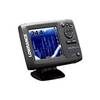
Elite 5x DSI - Fishfinder - included transducer : Skimmer DSI
-
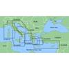
MapSource BlueChart - Ligurian Sea, Corsica and Sardinia - Maps
-
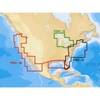
CFFISHW Map, USA Fish N Chip West & Gulf
-
Canadian Charts Juan de Fuca Strait to Dixon Entrance Chart
-
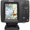
500 Series 587ci Combo - Marine Chartplotter - 4.5" color - 240 x 320
-
2777.91 FBRS 2777 Battery Replacement Service
-
Adventure Medical 0115-2000 Kit Marine 2000
-
Lopo Light Single Stb Vessel Size 40
-
30ft 24AWG Cat5e 350MHz UTP Bare Copper Ethernet Network Cable - White
-
C-Phone Kit - Includes Master Control Unit, 2 Handset Kits & 100' of Wire
-
Simnet Bulkhead Connector 11498961
-
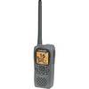
Low2217 LHR-80 VHF GPS Handheld Marine Radio