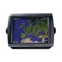
GPSMAP 5212 - Marine GPS receiver - 12.1" color - 1024 x 768
Model: 5212 Brand: Garmin
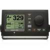
This flagship marine navigator is missing just one thing - buttons. The GPSMAP 5212 features an unprecedented touchscreen interface, along with preloaded BlueChart g2 maps of the U.S. coast and a whopping 12.1" screen that makes navigation as easy as pointing your finger. By connecting to the Garmin Marine Network, you can add sonar, radar and weather. The GPSMAP 5212 features highly-detailed BlueChart g2 marine cartography of the costal United States, including Alaska, Hawaii and the Bahamas. For other areas, the 5212 has a worldwide basemap with high-quality satellite images in place of more traditional maps. With the SD card slot, you can add additional maps without having to connect to a computer. The 5212's huge XGA screen displays graphics with crisp, video-quality resolution. To keep tabs on your engine room or other area of your boat, you can also connect a live video feed with the 5212's video input/output options. The 5212 connects easily to the high-speed Garmin Marine Network, so you can interface with additional MFDs and add remote sensors. Once connected, you can share information between the 5212 and other chartplotters on your boat. You can also add high-powered radar, sonar, and XM satellite weather and radio to your system. This product is bundled with GPS 17 with pole mount adapter. « less
Product Specification
-
General
Product Type: GPS receiverRecommended Use: MarinePreloaded Maps: USACard Reader: SD Memory CardInterface: NMEA 0183, NMEA 2000Included Software: Garmin Worldwide Marine BasemapCompatible Software: BlueChart g2 VisionSBAS: WAASAntenna: ExternalFeatures: Alarm, 2D / 3D map perspectiveFirst Seen On Google Shopping: April 2007 -
Display
Type: TFT - color - touch screenDiagonal Size: 12.1"Resolution: 1024 x 768 -
Navigation
Waypoints: 1500Tracks: 20Tracklog Points: 10000Routes: 20Trip Computer: Sunrise/sunset times, sun/moon positions -
Connections
Interfaces: Garmin Marine Network Composite video input -
Miscellaneous
Protection: WaterproofWaterproof Standard: IPX7Included Accessories: Protective cover, PC cable, mounting bracket, power cable -
Dimensions & Weight
Width: 13 inDepth: 4.7 inHeight: 9.5 inWeight: 9.5 lbs -
Universal Product Identifiers
Part Numbers: 010-00594-01, 5212GTIN: 00753759066109
Related Products
-
SP-70MS Autopilot for Cable Steer Straight Helms st70ms
-
AP50 Full Function Second Station sap50nd
-
Bahamas: NT+ Wide Coverage by C-Map
-
NAM033SD Mega Wide Atlantic CST & Carib
-
Audiopipe Ip2rca25 2 Ch Marine Oxygen Free RCA Cable 25 ft 2 Channel
-
Serial cable - (DB-37) - M - (DB-37) - F - 6 ft - PC
-
12-Volt Power Plug and Socket with Cover
-
Whisper Whi-500 230V, 3 KW (24Mph Wind) Wind Turbine with Controller
-
Product FCF0016000GS Air Conditioner 115V FCF16000
-
900 Series 957c Combo NVB CHO - Marine Chartplotter - 8" color - 800 x 480 - widescreen
-
GC10 Standard Image NTSC Marine Camera
-
1100 Series 1155c NVB - Marine Chartplotter - 10.4" color - 800 x 600