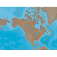
NAM033SD Mega Wide Atlantic CST & Carib
Model: NAM033SD Brand: C-Map
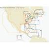
NA-M033 => Atlantic Coast, Gulf of Mexico and CaribbeanCoverage includes most of the eastern coastline of North America. Canadian coverage starts in Arctic Canada and continues east to Hudson Bay, Ungava Bay and Frobisher Bay before continuing south down the Labrador coast to Newfoundland, the Gulf of St. Lawrence and Nova Scotia. Lawrence River is covered down to Montreal. US coverage picks up at Passamaquoddy Bay and heads south down the Atlantic coast, picking up all of Chesapeake Bay, and continuing down to Key West, FL before turning into the Gulf of Mexico. The Gulf of Mexico, from Key West, FL to Brownsville, TX is covered in its entirety. Latin America is covered from the Mexico/US border over around the Yucatan Peninsula along the coasts of Belize, Honduras, Nicaragua, Costa Rica and through the Panama Canal before turning north up the Pacific coastline to Salina Cruz, Mexico. All the islands of the Caribbean are covered, from the Bahamas over to « less
Product Specification
-
Universal Product Identifiers
Part Numbers: 30153, NA-M033SD, NA-M033SDCARDGTIN: 00686074002876
Related Products
-
IR2 4.3 4KW 3.5 Foot Open Array Radar R-0005
-
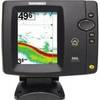
500 Series 586c - Fishfinder - included transducer : XNT-9-20-T - dual-beam
-
St. Lucie Inlet to Lake Pontchartrain: NT+ Wide Coverage by C-Map
-
010-C0752-10 Bluechart G2 HAF452SKnysna Sa to Beira MZ Data
-
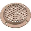
8" Round Bronze Strainer Made in The USA
-
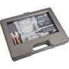
SY-ACC65060 130 Piece Networking & Telephone Installation Toolkit
-
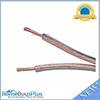
300ft 12AWG Enhanced Loud Oxygen-Free Copper Speaker Wire Cable
-
MOLEX to Dual 4-Pin Floppy Power Adapter Cable - MR1314
-
Patch cable - CAT 6 - RJ-45 - M - Unshielded twisted pair (UTP) 14 ft - Gray
-
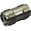
329950-1 UHF Dbl Female Connector
-
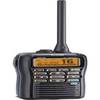
M92d Hand Held VHF
-
GPSMAP 421s GPS Dual Frequency Combo