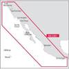
010-C0878-10 Bluechart G2 HAE003RTaiwan Data Card
Model: 010-C0878-10 Brand: Garmin
Covers mainland China from Macau to Shanghai, the Taiwanese coast in its entirety, and the Babuyan Islands to the south. Included in this overall general coverage are a number of detailed charts covering areas such as Chi-Lung, Tai., Kao-Hsiung, Tai., Shanghai, Chi., Xiamen, Chi., Guangzhou, Chi., and Hong Kong. See your surroundings more clearly with BlueChart g2 data. With BlueChart g2, you'll get detailed marine cartography that provides convenient viewing of nautical content. BlueChart g2 allows you to see your vessel's precise, on-chart position in relation to naviads, coastal features, anchorages, obstructions, waterways, restricted areas and more. You will also have access to detailed mapping capabilities that include Safety Shading , Fishing Charts , smooth data transition between zoom levels, harmonious transition across chart borders, and reduction of chart discontinuities. « less
Product Specification
-
Universal Product Identifiers
Part Numbers: 010-C0878-10, 10807014, 35777GTIN: 00753759090036
Related Products
-
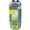
SARLink View 406 GPS PLB with Digital Display
-
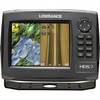
HDS-7 Gen2 Fishfinder GPS Chartplotter 53518700
-
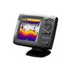
Elite 5x - Fishfinder - included transducer : Skimmer
-
NA-C601 Acapulco, Mexico to Cape Flattery
-
Vancouver Harbour,Eastern Portion Indian Arm Chart
-
Adventure Medical 0115-2000 Kit Marine 2000
-
68362P Amega 4-Gauge Set (SpeedTachFuelVolt)
-
50ft 24AWG Cat6 550mhz UTP Ethernet Bare Copper Network Cable - Red
-
3ft 28AWG High Speed HDMI Cable w/Ferrite cores - Black
-
04-1092-000R Standard VGA Cable Splitter
-
6ft Toslink to Mini M/M 5.0mm OD Molded Cable 1557
-
B45-DT-DX 600W Thru-Hull Transducer Lowrance 7-Pin Gray Connector