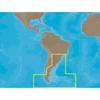
010-C0924-10 Bluechart G2 HAW005RThe Gulf & Red Sea Data Card
Model: 010-C0924-10 Brand: Garmin
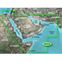
HAW005R Covers: Coverage of the Arabian Penninsula beginning at the Mediterranean Sea from Beirut to Alexandria. Coverage includes the Suez Canal, Gulf of Aqaba, and the Red Sea and Gulf of Aden in their entirety. Includes the Strait of Hormuz, Gulf of Oman, and coast of Somalia in the south. Coverage the of Kuwait, Saudi Arabia, Qatar, United Arab Emirates, along the southern coast of the Gulf and Iran along the northern coast. Coverage of Yemen and Oman coasts along the Indian Ocean to the Gulf of Oman, including Pakistan along the north coast, with general coverage of the Arabian Sea from Qamar Bay to the Delta of the Indus River. Included in this overall general coverage are numerous detailed charts covering areas such as Alexandria, Egy., Beirut, Leb., Al-Fuhaihil, Ad- Dammam, Bahrain, Ad-Dauha, and Abu Dhabi. Jiddah, Sau., Djibouti, Dji., and Aden, Yem. « less
Product Specification
-
Universal Product Identifiers
Part Numbers: 010-C0924-10, 35797GTIN: 00753759093273
Related Products
-
Chart Master V6i #U1-CHRT-V6i
-
K10-00012-07 GMR 406 XHD 4KW Pedestal & 6ft Open Array
-
SA-C003 C-Card Format - Rio de Janeiro - Cape Horn
-
E12099-P M ST7002 Plus Control Head Surface Mount
-
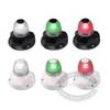
Marine Naviled 360 All-Round Navigation Light
-
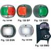
European Style Navigation Lights, Red Side Light, Black Perko
-
136-05 B744V Bronz Thru Hull
-
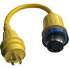
A50H30S 125/250VAC - 50 Amp -to- 125VAC - 30 Amp Straig
-
MWR150 Full Display Wired Marine Remote Control Map
-
CONNECTOR, Female Tab 16-14 x .187 25 Per Package
-
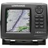
10520001 HDS-5m Gen2 Nautic Inst
-
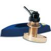
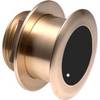
B175-12-L Broadband CHIRP, No CONNECTOR, Depth & Temperature Thru-Hull Tilted