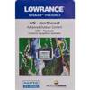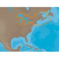
NA-M026 C-Card Format Great Lakes and The Maritimes
Model: NA-M026 Brand: C-Map
NA-M026 => Great Lakes, Northeast Coast and ApproachesCoverage of the Great Lakes, St. Lawrence River and Northeast United States. Coverage of the Great Lakes also includes Fox River and Lake Winnebago, Lake St. Clair, Rideau Canal, Ottawa River and the Trent-Severn Waterway. Includes all coastal charts for New Brunswick and Nova Scotia in Canada and Maine, New Hampshire, Massachusetts, Connecticut and New York in the U.S. Also included is coverage of the Hudson River and Lake Champlain as well as the Erie Barge Canal. Specifications:Port Plans: YesAerial Photos: Yes3-D View: Yes « less
Product Specification
-
Universal Product Identifiers
Part Numbers: 30127, NA-M026, NA-M026C-CARDGTIN: 000000165840, 00686074002791
Related Products
-
2-014 Outdoor US Northeast Chart for Endura Series
-
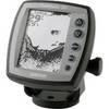
Fishfinder 90 - Fishfinder - included transducer - dual-beam
-
Max EM-M112 W19 South Meditterrean Sea-MAX
-
37636 HotMaps Platinum Multi-Dimensional 3D Lake Maps
-
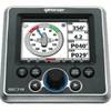
GSC Autopilot with Rudder feedback. No Drive 7000471
-
PiranhaMAX 190C - Fishfinder - portable - included transducer : XPT-9-20-T - single-beam
-
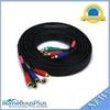
10ft 22AWG 5-rca Component Video/audio Coaxial Cable (RG-59/U) - Black
-
E22045 ST-40 Bidata System w/Nylon Thru Hulls
-
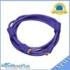
10ft 28AWG High Speed HDMI Cable w/Ferrite cores - Purple
-
6ft 28AWG DisplayPort Cable - White
-
TM00700 Connector Stainless
-
Mount 4079 1m RG58 W PL259 Connector