010-C0924-20 Bluechart G2 HXAW005RThe Gulf & Red Sea Microsd/sd
Model: 010-C0924-20 Brand: Garmin
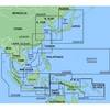
HXAW005R Covers: Coverage of the Arabian Penninsula beginning at the Mediterranean Sea from Beirut to Alexandria. Coverage includes the Suez Canal, Gulf of Aqaba, and the Red Sea and Gulf of Aden in their entirety. Includes the Strait of Hormuz, Gulf of Oman, and coast of Somalia in the south. Coverage the of Kuwait, Saudi Arabia, Qatar, United Arab Emirates, along the southern coast of the Gulf and Iran along the northern coast. Coverage of Yemen and Oman coasts along the Indian Ocean to the Gulf of Oman, including Pakistan along the north coast, with general coverage of the Arabian Sea from Qamar Bay to the Delta of the Indus River. Included in this overall general coverage are numerous detailed charts covering areas such as Alexandria, Egy., Beirut, Leb., Al-Fuhaihil, Ad- Dammam, Bahrain, Ad-Dauha, and Abu Dhabi. Jiddah, Sau., Djibouti, Dji., and Aden, Yem. « less
Product Specification
-
Universal Product Identifiers
Part Numbers: 010-C0924-20, 10807154, 35798GTIN: 00753759093280
Related Products
-
Skye Boat Song: String Bass (String Orchestra)
-
121-38 LRA 1800 Radome 18" 2KW Broad
-
RSB0070-064 24 rpm Gearbox with 4.0 KW Transceiver
-
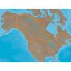
Max Lakes Canada C-Card NA-M048
-
MapSource BlueChart - Yellow Sea - Maps
-
BlueChart g2 Vision - St. Lawrence Seaway - Maps
-
Chartwork and marine navigation for fishermen and boat operators [Book]
-
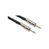
20' 1/4" Phone Male to 1/4" Phone Male Speaker Cable, 14 Awg, with 2 Conductors
-
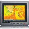
G120 Marine Display 12 Inch E62247 c31585
-
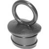
T-H Marine Pp118 Push Plug for 1-1/8 &Amp; 1-1/4
-
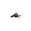
CP-12L Cigarette Light Adapter for M3A/M2A c10195
-
100ft 24AWG Cat6 550mhz UTP Ethernet Bare Copper Network