MapSource BlueChart - Morgan City-Brownsville - Maps
Model: Brand: Garmin
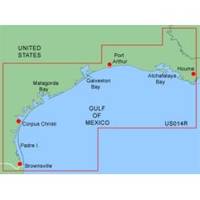
MapSource BlueChart is Garmin's exclusive marine cartography and was developed to provide you with mapping flexibility and options you've never had before. This line of cartography products is designed to provide interactive viewing of detailed nautical chart data, thereby providing navigators with innovative object-oriented cartography. These detailed electronic nautical charts look just like paper charts when displayed on your Garmin chartplotter. Features include shading between depth contours, spot soundings, navaids, port plans, wrecks, obstructions, inter-tidal zones, and more. BlueChart offers much larger coverage areas for half the price. Morgan City-Brownsville is a detailed coverage from Atchafalaya Bay to Brownsville, including Port Arthur, Galveston Bay, Matagorda Bay, and Padre Island. « less
Product Specification
-
General
Product Type: MapsDistribution Media: Garmin Data CardFirst Seen On Google Shopping: January 2006 -
Compatibility Information
Designed For: Garmin GPSMap 172C, 176, 176C, 178C, 178C Sounder, 182, 182C, 188 Sounder, 188C Sounder, 196, 2006, 2006C, 2010, 2010C, 2106C, 2110C, 2206C, 2210C, 232, 238 Sounder, 276C, 292C, 296, 298C, 3006C, 3010c, 3205C, 3206C, 3210C, 376C, 392C, 396C, 492C, 498C -
Universal Product Identifiers
Part Numbers: 010-C0028-00, Morgan City-BrownsvilleGTIN: 00753759031756
Related Products
-
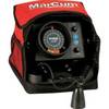
VX-1P 3-Color Sonar Flasher System
-
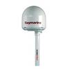
SC101 Radar Pole Mount 6' Kit for Raymarine 2KW/4KW Dome
-
010-C0877-20 Bluechart G2 HXAE002RYellow Sea Microsd/sd Adaptor
-
NT+ Wide Chart (americas) c11206
-
NT+ Wide Chart (New Zealand & Australian & Asia Region)
-
2766.6 Mini B300 ILS Personal Beacon
-
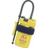
Adventure Medical 0115-2000 Kit Marine 2000
-
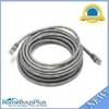
25ft 24AWG Cat6 500mhz Crossover Ethernet Bare Copper Network Cable - Gray
-
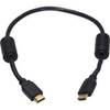
1.5ft 28AWG High Speed HDMI Cable w/Ferrite cores - Black
-
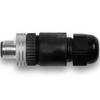
010-11094-00 NMEA 2000 Field Installable CONNECTOR, Male
-
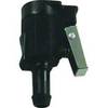
18 8076 Fuel Connector for Mercury/Mariner Outboard Motors
-
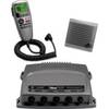
VHF 300 AIS VHF Radio with AIS Receiver