NT+ Wide Chart (New Zealand & Australian & Asia Region)
Model: Brand: C-Map
Cmap Chartplotter Compatibility Indian Ocean & Asia (W) Oceania (W) NT+ is the "next generation" of C-MAP electronic charts, featuring much wider coverage areas at substantially lower prices. NT+ C-card technology is reverse-compatible with current NT charting systems. Full benefits of improved chart display are optimized on systems Designed for NT+ (or by updating your NT system software to NT+). Vastly Expanded Coverage: Important advances in technology now permit C-MAP to offer significantly increased coverage areas without sacrificing compatibility or performance with current C-card based navigating systems. This has, in turn, resulted in much more coverage at a much lower cost! Extra Information Not Found On Official Government Charts: True Color NavAids - Extensive NavAid information, allowing for on-screen display in true shapes and colors. Port Info - Complete and detailed databases of port facilities, services and contact information. Tide Info - NT+ C-cards include primary and secondary tidal stations that can be queried for easy access while navigating. Easy-to-read graphs display depth at high and low water for sun-up and sun-down. Tidal predictions make travel planning easier and safer. Improved Chart Display: Paper Chart Appearance - All the advantages of electronic charts with the familiar look of a paper chart. C-MAP's experience with professional navigation and highly effective chart display has resulted in a new chart look for NT+. This new look makes creative use of colors, patterns and icons to increase the familiarity and usability of the content-rich NT+ database. New NavAid Symbols and Styles - Depending upon navigation situations and mariner's preference, Aids to Navigation can now be configured for three basic styles: INTERNATIONAL - NavAids shown in real life shapes and colors for quick visual recognition (as per official paper chart presentations). UNITED STATES - NavAids shown in simplified shapes and real colors (as generally found on NOAA paper charts). SIMPLIFIED - NavAids shown in generic symbols for minimum visual clutter on-screen. SIMPLE - Some selections are turned off, such as Light Sectors, Seabed Type, Tracks & Routes, Lat/Lon Grid. FISHING - Turns off even more selections, like Tides & Currents, Ports & Services, Rivers & Lakes, Chart Boundaries. CUSTOM - The navigator selects which features he'd like on the screen. What are the Differences Between NT+ Local, Wide & SuperWide C-cards? Simply put, the differences lie in the C-cards geographical coverage and pricing. They differ only in the amount of the boating area that the individual NT+ C-card covers. « less
Product Specification
-
Universal Product Identifiers
Part Number: c11206int
Related Products
-
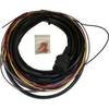
Boat (External) Wiring Harness Johnson/Evinrude OMC Green Plug New 473-9440 Instrument Cable Assembly
-
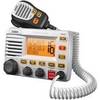
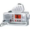
UM-525 GPS Intuitive Fixed Mount VHF/Loud Hailer Marine Radio - White
-
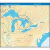
NT+ Wide Map, Ohio River: Cairo to Pittsburg NA-C039
-
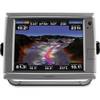
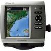
010-00749-01 - GPSMAP 7212, 12 Tchscrn MFD, Coast Map
-
R10 Safelink SRS (MOB) AIS Recovery System
-
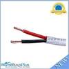
250ft 18AWG CL2 Rated 2-Conductor Loud Speaker Cable (for In-Wall Installation)
-
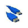
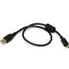
USB extension cable - 9 pin USB Type A - M - 9 pin USB Type A - F - 10 ft - PC
-
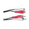
Video / audio extension cable - Female RCA phono x 2 to M RCA phono x 2
-
1.5ft USB 2.0 A Male to Mini-B 4pin Male 28/24AWG Cable w/ Ferrite Core (Gold Plated)
-
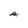
CP-12L Cigarette Light Adapter for M3A/M2A c10195
-
Eclipse DSC GX1000 - VHF Marine Radio
-
GPSMAP 526 - Marine Chartplotter - 5" color - 480 x 640