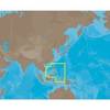
010-C1002-20 Bluechart G2 HXEU059RGreenland East Microsd/sd ADA
Model: 010-C1002-20 Brand: Garmin
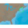
See your surroundings more clearly with BlueChart g2 data. With BlueChart g2, you’ll get detailed marine cartography that provides convenient viewing of nautical content. BlueChart g2 allows you to see your vessel’s precise, on-chart position in relation to naviads, coastal features, anchorages, obstructions, waterways, restricted areas and more. You will also have access to detailed mapping capabilities that include Safety Shading, Fishing Charts, smooth data transition between zoom levels, harmonious transition across chart borders, and reduction of chart discontinuities. Covers: Detailed coverage of the Eastern coast of Greenland from Germania Land around the southern tip of Greenland to Godthab (Nuuk) on the SW coast: Also details Jameson Land, Ammassalik, Julianehab (Qaqortoq), and Nanortalik. « less
Product Specification
-
Universal Product Identifiers
Part Numbers: 010-C1002-20, 10807212, 35804GTIN: 00753759090340
Related Products
-
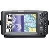
HDS-8 Base Mltfnc Fishfinder/Chartplotter w/ 83/200 K 34255
-
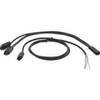
Motor/Sonar Connector Plug
-
GMR24 HD Radar 24 Inch 4KW 48NM Range High Definition Dome with 15 Meter Cable 010-00572-03
-
NA-C301 Furuno FP Format Passamaquoddy ? Narragansett
-
AS-M205 C-Card Format Philippines
-
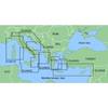
MapSource BlueChart - Adriatic Sea, South Coast - Maps
-
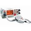
Mr F75 Fixed Mount Marine VHF Transceiver with Tri-Watch and Pa Capability - White, MRF75
-
SP36-12 Autopilot Virtual Feedback 30CI Pumpset
-
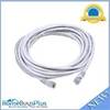
20ft 24AWG Cat6 550mhz UTP Ethernet Bare Copper Network 5015
-
Ashhgps Matrix HH Connect Kit by Humminbird
-
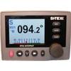
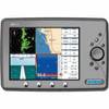
Marine EC11 GPS-Chartplotter/Fish Finder with External Antenna, C-Map Max Card & 10.4" Color Display; NMEA Network Compatible - SI-TEX
-
900 Series 997c SI Combo NVB - Marine Chartplotter - 8" color - 800 x 480 - widescreen