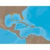
010-C1020-20 Bluechart G2 HXPC024RAustralia & New Zealand
Model: 010-C1020-20 Brand: Garmin
See your surroundings more clearly with BlueChart g2 data. With BlueChart g2, you'll get detailed marine cartography that provides convenient viewing of nautical content. BlueChart g2 allows you to see your vessel's precise, on-chart position in relation to naviads, coastal features, anchorages, obstructions, waterways, restricted areas and more. You will also have access to detailed mapping capabilities that include Safety Shading, Fishing Charts, smooth data transition between zoom levels, harmonious transition across chart borders, and reduction of chart discontinuities. Covers: Detailed coverage of the entire continent of Australia and New Zealand. Coverage includes Brisbane, Sydney, and the Great Barrier Reef along the Eastern coast. Coverage continues along the Southern coast including Melbourne, Adelaide, and Tasmania through the Great Australian Bight. Coverage also includes Perth, Geraldton, Darwin, and the Gulf of Carpentaria on the Western and Northern coasts. « less
Product Specification
-
Universal Product Identifiers
Part Numbers: 010-C1020-20, 10807238, 35814GTIN: 00753759095499
Related Products
-
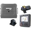
T12118 Raymaine ST70 SmartPilot X-10 Hydraulic System for
-
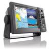
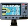
EC5EF 5 Inch GPS Chartplotter Fishfinder Combo External Antenna
-
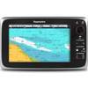
T70027 C97 Multifunction Display W Sonar - US Inland Charts
-
NavNet 1934C NT VX2 10.4 Inch 4KW 48NM Radar System with 3.5' Open Array c16826
-
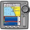
NA-C401 C-Card Format - St. Lucie Inlet LK Pontch
-
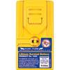
1066 Replacement Lithium Battery for 2726 and 2727
-
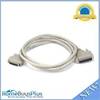
6ft DB-25(IEEE-1284) Male to Mini/Micro Centronic 36(hpcn36) Male Cable [IE]
-
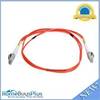
Fiber Optic Cable, LC/LC, Multi Mode, Duplex - 1 Meter 6202
-
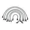
18-8810-1 Premium Marine Spark Plug Wire Leads
-
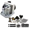
FCF5000 Kit with AC, Seawater & Ducting - 115V FCFK016A c44588
-
CRC Marine Electronics Die-Lectic Grease 06106 (3.3 oz.)
-
Colormax Wide Internal Wide 7 Inch Panoramic LCD with Internal