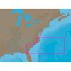
010-C1025-20 Bluechart G2 HXEU718LMediterranean Sea Microsd/sd
Model: 010-C1025-20 Brand: Garmin
See your surroundings more clearly with BlueChart g2 data. With BlueChart g2, you’ll get detailed marine cartography that provides convenient viewing of nautical content. BlueChart g2 allows you to see your vessel’s precise, on-chart position in relation to naviads, coastal features, anchorages, obstructions, waterways, restricted areas and more. You will also have access to detailed mapping capabilities that include Safety Shading, Fishing Charts, smooth data transition between zoom levels, harmonious transition across chart borders, and reduction of chart discontinuities. Covers: Detailed offshore coastal coverage of the Mediterranean Sea in its entirety. Coverage features the Strait of Gibraltar, the Balearic Islands, the French Riviera, Corsica, Sardinia, Sicily, the Adriatic Sea, the Greek Islands, the Aegean Sea, the Dardanelles and Bosporus Straits, the Sea of Marmara, Cyprus, the Suez Canal, Tripoli and Algiers Harbors, and the Gulfs of Gab « less
Product Specification
-
Universal Product Identifiers
Part Numbers: 010-C1025-20, 10807295, 35822GTIN: 00753759096250
Related Products
-
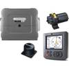
T12118 Raymaine ST70 SmartPilot X-10 Hydraulic System for
-
NA-C304 Furuno FP Format Norfolk Bermuda Jac
-
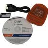
PCPLANNER2 PC Planner - NT+/MAX 2MB
-
How To Read a Nautical Chart: A Captain's Quick Guide [Book]
-
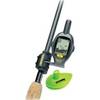
SmartCast RF25 - Fishfinder - portable - included transducer : RF45 - single-beam
-
25ft 24AWG Cat6 550mhz UTP Ethernet Bare Copper Network Cable - Gray
-
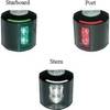
Series 43 LED Navigation Lights, Ser 43 White LED Nav Light Strbd
-
100ft 24AWG Cat6a 500mhz Stp Ethernet Bare Copper Network Cable - Blue
-
1447 3ft Optical Toslink 5.0mm OD Audio Cable
-
000-0136-02 - 50/200kHz /T, PL Lo-Pro Xdcr, Blue CON
-
B45-DT-HB 600W Thru-Hull Transducer Humminbird #9 Connector
-
Terk Sirmarine Satellite Radio Antenna