3208 l. Powell So
Model: 3208 Brand: Fish-n-Map
FISH-N-MAP UNDERWATER TOPOGRAPHY MAPSMade of waterproof, tear resistant plastic. Features include: underwater depth contours, fish locations, latitude and longitude for GPS, multiple freshwater lakes on one map, boat ramps, recreational facilities and much more.
Product Specification
-
Universal Product Identifiers
Part Numbers: 250129, 3208GTIN: 00761428032089
Related Products
-
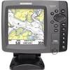
700 Series 786ci - Marine Chartplotter - 5" color - 640 x 640
-
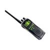
ATLANTIS 250 VHF Two-way radio
-
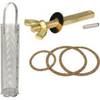
0493DP999M Cork Gasket Kit Sizes 8, 9, 10
-
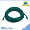
30ft 24AWG Cat6 550mhz UTP Ethernet Bare Copper Network Cable - Green
-
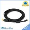
15ft USB 2.0 A Male to Mini-B 5pin Male 28/24AWG Cable w/ Ferrite Core (Gold Plated)
-
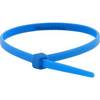
Cable Tie 4 Inch 18LBS, 100pcs/Pack - Blue
-
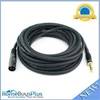
25ft Premier Series XLR Male to 1/4inch TRS Male 16AWG Cable (Gold Plated)
-
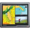
G190 Marine Display 19" 31588
-
Ez-13200 Quick Connect
-
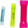
Butt CONNECTOR, Single CRIMP, Nylon Insulated Yellow, 12-10, 100 Pack
-
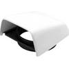
Marine Cowl Vent w/Hose Adapter f/4 BEC-C8
-
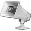
VIP-130L-M-IC - IP horn, Marine (White)