408430-1M 385cxi Di Fishfinder GPS Combo - International Un
Model: 408430-1M Brand: Humminbird
International Features:Menu Selection for: Feet, fathoms, or meters - MPH or KPHMultiple Languages - Note: International Units also include all USA features as well3.5" high-resolution 320Vx240H LCD color display with backlighting. - Beam PLUS technology provides 16° and 25° beams to see below the boat with better structure and bottom hardness definition. Use Down Imaging to reveal cover and structure detail below your boat.3.5" Display 320V x 240H, 256 Color - Down Imaging 455k - Hz / 45° @ -10dbDualBeam PLUS w/ SwitchFire200kHz / 25° @ -10db455k - Hz / 16° @ -10db - Depth 250 ft (DI), 600 ftDualBeam PLUS4000 W (PTP)Sonar Coverage500 W (RMS)GPS Receiver Precision GPSCartography HumminbirdUniMapSD Card Slot Single « less
Product Specification
-
Universal Product Identifiers
Part Numbers: 408430-1M, 46357GTIN: 00082324035821, 82324035821
Related Products
-
Skye Boat Song: String Bass (String Orchestra)
-
iScan V90 Forward Looking Sonar 16407
-
Training DVD f/Lowrance X47/X47EX/X51/X58DF N2329DVD
-
LMP-2 F/ Sitex Simrad et Al Domes
-
Max AN-M001 MW11 East China Sea to Kamchatka-MAX
-
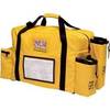
2272 Rapid Ditch Bag
-
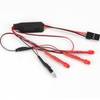
EFLH2009R MD520N LED Navigation Light Set
-
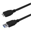
USB 3.0 Micro Cable | 6ft | Type A | Micro Type B | Black
-
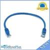
1ft 24AWG Cat5e 350MHz UTP Bare Copper Ethernet Network Cable - Blue
-
6ft 30AWG High Speed HDMI Cable - HDMI Connector to HDMI Mini Connector - Black
-
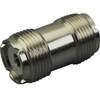
329950-1 UHF Dbl Female Connector
-
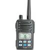
IC-M88-IS Intrinsically Safe Handheld VHF Marine Radio