Hydrographical Surveying. a Description of the Means and Methods Employed in Constructing Marine Charts. [Book]
Title: Hydrographical Surveying. A description of the means and methods employed in constructing marine charts.Publisher: British Library, Historical Print EditionsThe British Library is the national library of the United Kingdom. It is one of the world's largest research libraries holding over 150 million items in all known languages and formats: books, journals, newspapers, sound recordings, patents, maps, stamps, prints and much more. Its collections include around 14 million books, along with substantial additional collections of manuscripts and historical items dating back as far as 300 BC.The GEOLOGY collection includes books from the British Library digitised by Microsoft. The works in this collection contain a number of maps, charts, and tables from the 16th to the 19th centuries documenting geological features of the natural world. Also contained are textbooks and early scientific studies that catalogue and chronicle the human stance toward water and land use. Readers will further enjoy early historical maps of rivers and shorelines demonstrating the artistry of journeymen, cartographers, and illustrators. ++++The below data was compiled from various identification fields in the bibliographic record of this title. This data is provided as an additional tool in helping to insure edition identification: ++++ British Library Wharton, K.C.B.; 1882. vii. 360 p.; 8 . 10498.c.14. « less
Product Specification
-
Authors: K. C. B. WhartonPages: 420Format: paperbackPublication Date: 2011.03
-
Universal Product Identifiers
ISBN: 1241386935GTIN: 09781241386931
Related Products
-
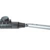
1441 HANDI- Mate O.B. Handle w/Swivel
-
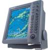
T-940-3 8.4 Inch LCD Display 4KW 48NM Radar with 3.5' Open Array and 10 Meter Cable 33602
-
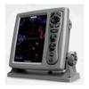
FR8252 12.1 Color LCD 25KW 15 Mtr Cable No Antenna
-
Max EW-M225 W15 France Inland-MAX
-
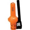
86-300-001A S-4 Sart
-
Navigational Systems and Simulators: Marine Navigation and Safety of Sea Transportation [Book]
-
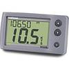
E22045 ST-40 Bidata System w/Nylon Thru Hulls
-
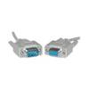
100 ft Serial cable 9 pin D-Sub (DB-9) - male - 9 pin D-Sub (DB-9) - female - PC
-
6ft Premier Series XLR Male to XLR Female 16AWG Cable (Gold Plated) [Microphone & Interconnect]
-
Network cable - 2 x SC MM - M - 2 x ST MM - M - Fiber optic 16.4 ft
-
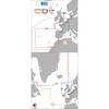
GPS 95CP Color LCD GPS/WAAS Chartplotter C30841
-
MA-500TR Kit AIS Transponder with MX-G5000 GPS Receiver Class B