8265; Map-Lake Camanche/Folsom Lake
Model: 8265 Brand: Fish-n-Map
FISH-N-MAP UNDERWATER TOPOGRAPHY MAPSMade of waterproof, tear resistant plastic. Features include: underwater depth contours, fish locations, latitude and longitude for GPS, multiple freshwater lakes on one map, boat ramps, recreational facilities and much more.
Product Specification
-
Universal Product Identifiers
Part Numbers: 235310, 8265GTIN: 00761428082657
Related Products
-
Scp 110 Autopilot Course Computer Rate Gyro
-
Package(e127 with aus, NZ, S. America, Asia Chart, 4KW 18 Inch Digital Radome & Radar Cable)
-
VHF 300i ais, International Garmin 10972206
-
Max EN-M604 W34 Russian Lakes-MAX
-
RADIO-FIX VHF Class-D DSC Wht
-
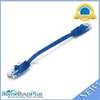
0.5ft 24AWG Cat5e 350MHz UTP Ethernet Bare Copper Network
-
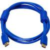
6ft 28AWG High Speed HDMI Cable w/Ferrite cores - Blue
-
PH6625 Male Connector Phone
-
18-80406; Fuel Connector- Honda
-
7ft 24AWG Cat6 550mhz UTP Ethernet Bare Copper Network Cable - Purple
-
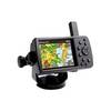
GPSMAP 478 - Marine GPS receiver - 3.8" color - 480 x 320
-
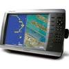
GPSMAP 4010 Plotter with GPS Antenna 010-00690-00