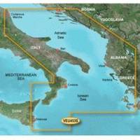
BlueChart g2 Vision - Adriatic Sea, South Coast - Maps
Model: Brand: Garmin
BlueChart g2 Vision offers the same rich detailed charting of BlueChart g2 to help you get the most out of your unit. In addition, g2 Vision features a growing database of high-resolution satellite imagery, above and below the water 3D perspective, auto guidance technology, aerial photographs for real world reference and coastal roads with points of interest. This product features detailed coverage of the Italian coast: from Porto Civitanova to extend south to Siracusa, Sicilia. From Split, Croatia to Killini, Greece « less
Product Specification
-
General
Product Type: MapsDistribution Media: SD Memory CardFirst Seen On Google Shopping: June 2007 -
Compatibility Information
Designed For: Garmin GPSMAP 4008, 4012, 420, 4208, 420s, 4212, 430, 430s, 430sx, 430x, 440, 440s, 440sx, 440x, 450, 5008, 5012, 520, 5208, 520s, 5212, 525, 525s, 530, 530s, 535, 535s, 540, 540s, 545, 545s, 550, 550s, 555, 555s -
Universal Product Identifiers
Part Numbers: 010-C0797-00, Adriatic Sea, South CoastGTIN: 00753759069773
Related Products
-
AP2402 Autopilot AP24,AC42,RC42,RF300 No Drive
-
SD/638P+ Pugent Sound Plat+On M155Sd
-
Max EN-M604 W34 Russian Lakes-MAX
-
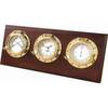
312800 Porthole 3 Instrument Plaque
-
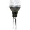
5500 Series LED All Around Navigation Lights 54" Straight Pole
-
50ft 24AWG Cat6 550mhz UTP Ethernet Bare Copper Network Cable - Yellow
-
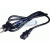
6ft 18AWG Power Cord Cable w/ 3 Conductor PC Power Connector Socket (C13/5-15P) - Black
-
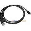
3ft USB 2.0 A Male to Micro 5pin Male 28/24AWG Cable w/ Ferrite Core (Gold Plated)
-
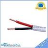
250ft 18AWG CL2 Rated 2-Conductor Loud Speaker Cable (for In-Wall Installation)
-
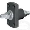
Terminal Feed Through Connector
-
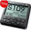
GPSMAP 421 - Marine Chartplotter - 4" color - 240 x 320
-
GPS 95CP Color LCD GPS/WAAS Chartplotter C30841