BlueChart g2 Vision - Jacksonville to Key West - Maps
Model: Brand: Garmin
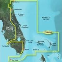
BlueChart g2 Vision offers the same rich detailed charting of BlueChart g2 to help you get the most out of your unit. In addition, g2 Vision features a growing database of high-resolution satellite imagery, above and below the water 3D perspective, auto guidance technology, aerial photographs for real world reference and coastal roads with points of interest. This product features data from explorer charts for the Bahamas! Darien, GA to Key West, FL including the entire St. John's River, the St. Lucie Canal, Lake Okeechobee, with coverage over to Ft. Myers. Also includes detailed coverage of Bimini, the Abacos and Grand Bahama Island. « less
Product Specification
-
General
Product Type: MapsDistribution Media: SD Memory CardFirst Seen On Google Shopping: May 2007 -
Universal Product Identifiers
Part Numbers: 010-C0710-00, Jacksonville to Key WestGTIN: 00709637032643, 00753759068905 -
Compatibility Information
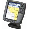
Designed For: Garmin GPSMAP 4008, 4012, 420, 4208, 420s, 4212, 430, 430s, 430sx, 430x, 440, 440s, 440sx, 440x, 450, 5008, 5012, 520, 5208, 520s, 5212, 525, 525s, 530, 530s, 535, 535s, 540, 540s, 545, 545s, 550, 550s, 555, 555s
Related Products
-
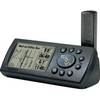
E32153 Raystar 130 GPS Antenna
-
Chart Master V6i #U1-CHRT-V6i
-
SD651P Cent Gulf of MX Plat+On M155Sd
-
TXOKC1 LakeMaster Map Texas/Oklahoma Electronic Char
-
Paper Chart Kit Book Region 04 Ches Bay and Del Bay
-
6ft 24AWG CL2 Flat High Speed HDMI Cable - Black
-
Cat6a Ethernet Cable | 15ft | White | Network | 10 Gigabit
-
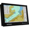
MD-124Y 24 Inches Marine Display with 16:9 Aspect Ratio. Full HD (1920x108
-
010-11454-00 GPS Antenna Cable w/BNC Connectors - 10M
-
8.0 Beg Generator
-
GPS V Deluxe - Marine, hiking, automotive GPS receiver - Monochrome - 256 x 160
-
n�vi 2555LT - Automotive GPS receiver - 5" color - 480 x 272 - widescreen