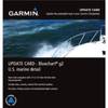
BlueChart g2 Vision - Lake Erie - Lake St. Clair - Maps
Model: Brand: Garmin
BlueChart g2 Vision offers the same rich detailed charting of BlueChart g2 to help you get the most out of your unit. In addition, g2 Vision features a growing database of high-resolution satellite imagery, above and below the water 3D perspective, auto guidance technology, aerial photographs for real world reference and coastal roads with points of interest. This product features coverage of both the U.S. and Canadian sides of the southern portion of Lake Huron. Detailed coverage of the St. Clair River, Lake St. Clair, Detroit River, and the U.S. portion of Lake Erie through Buffalo. Also includes coverage of the Canadian portion of Lake Erie and the western side of Lake Ontario, including detailed coverage of Long Point Bay, Welland Canal, the Niagara River, and Toronto. « less
Product Specification
-
General
Product Type: MapsDistribution Media: SD Memory CardFirst Seen On Google Shopping: May 2007 -
Compatibility Information
Designed For: Garmin GPSMAP 4008, 4012, 420, 4208, 420s, 4212, 430, 430s, 430sx, 430x, 440, 440s, 440sx, 440x, 450, 5008, 5012, 520, 5208, 520s, 5212, 525, 525s, 530, 530s, 535, 535s, 540, 540s, 545, 545s, 550, 550s, 555, 555s -
Universal Product Identifiers
Part Numbers: 010-C0719-00, Lake Erie - Lake St. ClairGTIN: 00753759068998
Related Products
-
SP-80R Autopilot with 18 Cu Inch Pump & Rotary Feedback for Inboard Outboard & Sterndrive c10442
-
E12138 SmartPilot X-5 Tiller Grand Prix Corepack - Control H
-
T70033 C127 Multifunction Display w/Sonar - European Charts
-
Package(e7 with aus, NZ, S. America, Asia Chart, 4KW 24 Inch Digital Radome & Radar Cable)
-
010-10800-72 Bluechart G2 Map Update
-
T52085 RA1048SHD - 4KW 48 in. in. Super HD
-
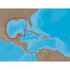
NA-C402 Pensacola Bay to Honduras
-
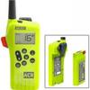
2828 SR203 GMDSS Survival Radio w/Replacable Lithium B
-
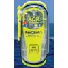
2881 ResQLink Plus PLB375
-
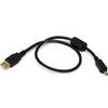
1.5ft USB 2.0 A Male to Mini-B 4pin Male 28/24AWG Cable w/ Ferrite Core (Gold Plated)
-
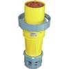
100HF1 120/250VAC - 100 Amp Female Connector
-
LTD 50HF1 50 Amp 125 Volt Female Connector