Marine World Chart of Nicolo de Canerio Januensis, Circa 1502: A Critical Study (1908) [Book]
Model: 1502 Brand:
This scarce antiquarian book is a selection from Kessinger Publishing's Legacy Reprint Series. Due to its age, it may contain imperfections such as marks, notations, marginalia and flawed pages. Because we believe this work is culturally important, we have made it available as part of our commitment to protecting, preserving, and promoting the world's literature. Kessinger Publishing is the place to find hundreds of thousands of rare and hard-to-find books with something of interest for everyone! « less
Product Specification
-
Authors: Edward Luther StevensonPages: 148Format: paperbackPublication Date: 2010.09
-
Universal Product Identifiers
ISBN: 1164058703GTIN: 09781164058700
Related Products
-
AP2402VRF Autopilot AP24,AC42,RC42,NO Drive
-
Max Mega Wide International cmegai
-
190 Marine Navigation LIGHTrule Lights Shapes
-
Seacock Body, 3/4 Inch Pipe Size 0805005PLB
-
25ft 22AWG 3-RCA Component Video Coaxial Cable (RG-59/U) - Black
-
Phone Cable, RJ12 (6p6c), Reverse - 25ft for voice
-
252150 Butt Connector #4 HD 2/pk
-
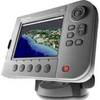
E62111-US - C90Wide 9 MFD, US Charts, Int GPS
-
F-Splice-CP/GH-01 Connector for RG-6U Cable
-
Marine Products Terminal, Spark Plug Wire 9-28122
-
010-10742-00 Control Area Network (Can) Kit
-
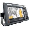
E62190 - A70 6.4 Chartplotter, Int GPS, w/o Maps