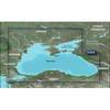
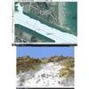
BlueChart g2 Vision - Lake Huron - Lake St. Clair - Maps
Model: Brand: Garmin
BlueChart g2 Vision offers the same rich detailed charting of BlueChart g2 to help you get the most out of your unit. In addition, g2 Vision features a growing database of high-resolution satellite imagery, above and below the water 3D perspective, auto guidance technology, aerial photographs for real world reference and coastal roads with points of interest. This product features detailed coverage of Lake Huron, Georgian Bay, Lake St. Clair, Lake Simcoe, Lac Nipissing, and the Detroit River. Covers from Sault Ste. Marie to Detroit, including Saginaw, on the U.S. side, and from Sault Ste. Marie to Goderich, Ont., including Parry Sound, on the Canadian side. « less
Product Specification
-
General
Product Type: MapsDistribution Media: SD Memory CardFirst Seen On Google Shopping: May 2007 -
Universal Product Identifiers
Part Numbers: 010-C0718-00, Lake Huron - Lake St. ClairGTIN: 00753759068981 -
Compatibility Information
Designed For: Garmin GPSMAP 4008, 4012, 420, 4208, 420s, 4212, 430, 430s, 430sx, 430x, 440, 440s, 440sx, 440x, 450, 5008, 5012, 520, 5208, 520s, 5212, 525, 525s, 530, 530s, 535, 535s, 540, 540s, 545, 545s, 550, 550s, 555, 555s
Related Products
-
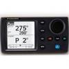
NAVPILOT700OB Autopilot
-
8M4000386 Wireless Sonar Adapter Lowrance 7-Pin
-
010-C1064-20 G2 HXRU002R Black Sea & Azov Bluechart SD
-
Studio Arts Kids Under The Sea Growth Chart GCUS-01W
-
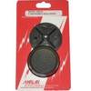
Marlan Inst Hole Cvr 2in Rd Instrument Hole Covers 530001C
-
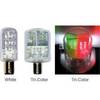
Navigation Light BAY15d Replacement Bulb 9353400
-
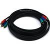
10ft 22AWG 3-RCA Component Video Coaxial Cable (RG-59/U) - Black
-
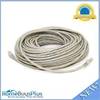
100ft 24AWG Cat6 500mhz Crossover Ethernet Bare Copper Network Cable - Gray
-
20ft 24AWG Cat6 550mhz UTP Ethernet Bare Copper Network Cable - Orange
-
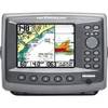
Matrix 97 Sonar - Fishfinder - included transducer : XNT-9-20-T - dual-beam
-
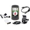
010-00924-07 Montana Marine Bundle - Mount, AC Charger, USB, Ba
-
FUGMAR-4 Marine 4 PC Navigation Software v4.5 - Upgradable to 5