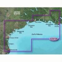
BlueChart g2 Vision - Morgan City to Brownsville - Maps
Model: Brand: Garmin
BlueChart g2 Vision offers the same rich detailed charting of BlueChart g2 to help you get the most out of your unit. In addition, g2 Vision features a growing database of high-resolution satellite imagery, above and below the water 3D perspective, auto guidance technology, aerial photographs for real world reference and coastal roads with points of interest. This product features Atchafalaya Bay to Brownsville, including Port Arthur, Galveston Bay, Matagorda Bay, and Padre Island. « less
Product Specification
-
General
Product Type: MapsDistribution Media: SD Memory CardFirst Seen On Google Shopping: May 2007 -
Compatibility Information
Designed For: Garmin GPSMAP 4008, 4012, 420, 4208, 420s, 4212, 430, 430s, 430sx, 430x, 440, 440s, 440sx, 440x, 450, 5008, 5012, 520, 5208, 520s, 5212, 525, 525s, 530, 530s, 535, 535s, 540, 540s, 545, 545s, 550, 550s, 555, 555s -
Universal Product Identifiers
Part Numbers: 010-C0715-00, Morgan City to BrownsvilleGTIN: 00708651888465, 00753759068950
Related Products
-
SP110VF-7 SP-110 System w/Virtual Feedback & Mechanical Remote
-
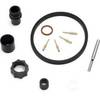
010-00484-04 - 6' Open Array for XHD Pedestal
-
DVD - The Boaters Guide to Using Marine Radar N8991DVD
-
701S-00616 ARH100 Automatic Hydostatic Release Housing
-
PFD 33 Gram Manual Inflatable Chest Pak in Navy Size: Small / Medium
-
41320-1 S41 Port Navigation Light 24V, Black
-
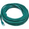
25ft 24AWG Cat5e 350MHz UTP Bare Copper Ethernet Network Cable - Green
-
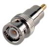
010-11376-00 BNC/RCA Adapter f/GC 10 Cameras
-
TC-3 Transducer Connector - Grey wtc3
-
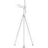
Mounting Kit for Wind Turbines - Marine Applications, Model#
-
lian i3 System Dish Network w/Multi-Satellite Interface & Dish
-
FishElite 480 - Marine Chartplotter - 5" monochrome - 480 x 480