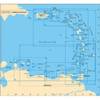
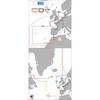
BlueChart g2 Vision - North Slope Alaska - Maps
Model: Brand: Garmin
BlueChart g2 Vision offers the same rich detailed charting of BlueChart g2 to help you get the most out of your unit. In addition, g2 Vision features a growing database of high-resolution satellite imagery, above and below the water 3D perspective, auto guidance technology, aerial photographs for real world reference and coastal roads with points of interest. This product features detailed coverage of the northern coast of Alaska from Point Hope to the United States/Canadian border including Point Barrow, Kaktovik, and Peard Bay. « less
Product Specification
-
General
Product Type: MapsDistribution Media: SD Memory CardFirst Seen On Google Shopping: May 2007 -
Compatibility Information
Designed For: Garmin GPSMAP 4008, 4012, 420, 4208, 420s, 4212, 430, 430s, 430sx, 430x, 440, 440s, 440sx, 440x, 450, 5008, 5012, 520, 5208, 520s, 5212, 525, 525s, 530, 530s, 535, 535s, 540, 540s, 545, 545s, 550, 550s, 555, 555s -
Universal Product Identifiers
Part Numbers: 010-C0736-00, North Slope AlaskaGTIN: 00753759069162
Related Products
-
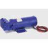
Constant Running Hydraulic Pump - Size 4 - 24V
-
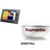
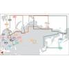
Package(C140W, 4KW 18 Inch Digital Radome & Radar Cable)
-
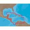
NA-C502 Furuno FP Format Western Caribbean S
-
A28 Imray Guadeloupe Marine Nautical Chart
-
Max RS-M202 W36 Russian Federation NW-MAX
-
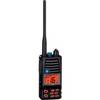
HX370SAS Intrinsically Safe Submersible 5 Watt Marine
-
Max EW-M227 W3 Norhtwest European Coasts-MAX
-
AP2401VRF Autopilot AP24,AC12,RC42 No Drive Unit
-
Cat6a Ethernet Cable | 5ft | Black | Network | 10 Gigabit
-
10ft 24AWG Cat5e 350MHz UTP Bare Copper Ethernet Network Cable - Yellow
-
3ft 24AWG Cat5e 350MHz UTP Bare Copper Ethernet Network Cable - Blue
-
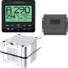
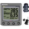
T22050-P ST60 Plus Tridata w/Removeable Thru Hulls