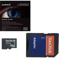
BlueChart g2 Vision - South Maine - Maps
Model: Brand: Garmin
BlueChart g2 Vision offers the same rich detailed charting of BlueChart g2 to help you get the most out of your unit. In addition, g2 Vision features a growing database of high-resolution satellite imagery, above and below the water 3D perspective, auto guidance technology, aerial photographs for real world reference and coastal roads with points of interest. This product features Penobscot Bay through Gloucester, including Casco Bay and Cape Ann. « less
Product Specification
-
General
Product Type: MapsDistribution Media: SD Memory CardFirst Seen On Google Shopping: May 2007 -
Universal Product Identifiers
Part Numbers: 010-C0703-00, South MaineGTIN: 00753759068837 -
Compatibility Information
Designed For: Garmin GPSMAP 4008, 4012, 420, 4208, 420s, 4212, 430, 430s, 430sx, 430x, 440, 440s, 440sx, 440x, 450, 5008, 5012, 520, 5208, 520s, 5212, 525, 525s, 530, 530s, 535, 535s, 540, 540s, 545, 545s, 550, 550s, 555, 555s
Related Products
-
Package(C120W, 4KW 24 Inch Digital Radome & Radar Cable)
-
500 Series 565 Portable - Fishfinder - portable - included transducer : XNT-9-20-T - dual-beam
-
PC Planner NT 128KB for Raymarine
-
GPSMAP 525s - Marine Chartplotter - 5" color - 480 x 640
-
Bulk cable - CAT 6 - Unshielded twisted pair (UTP) 1000 ft - Black
-
8ft 24AWG CL2 High Speed HDMI Cable w/ Net Jacket - Black
-
25ft 24AWG CL2 Standard HDMI Cable - White
-
8ft db9/data Token Ring Cable
-
010-10603-00 Radar Connector c17064
-
E42001 - VHF, Ray240, Modular w/Hailer
-
3ft 24AWG Cat6 550mhz UTP Ethernet Bare Copper Network Cable - Orange
-
GPS 72 - Marine, hiking GPS receiver - Monochrome - 120 x 160