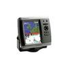
GPSMAP 525s - Marine Chartplotter - 5" color - 480 x 640
Model: 525s Brand: Garmin
This chartplotter provides the brightest, sharpest, most colorful graphics you've ever seen on a 5-inch screen. See clearly as you navigate with the 525's crisp, sunlight-readable VGA display driven by a high-speed processor. This chartplotter offers exceptional detail, fast redraw rates, and the most realistic photo-enhanced cartography ever seen in this class of fixed-mount electronics. The 525's worldwide basemap can be enhanced with the optional BlueChart g2 Vision card, which provides high-resolution aerial reference photos for help navigating tricky harbors and channels - or locating spots like area marinas, fuel stops or restaurants. The g2 Vision plug-in SD data card also allows the GPSMAP 525 to graphically depict a true 3D "mariner's eye" topside view or "fish eye" underwater navigation perspective. With fewer buttons to push and fewer operational steps to navigate, the GPSMAP 525's simplified menu format makes it easy for you to see and select the data you want to access on-screen. The 525s comes with powerful dual frequency or dual beam sonar to clearly paint depth contours, fish targets, structure, etc. It's also CANet capable, allowing sounder data to be shared with other plotter displays on your boat. « less
Product Specification
-
General
Product Type: ChartplotterRecommended Use: MarineReceiver: 12 channelCard Reader: SD Memory CardInterface: NMEA 0183Included Software: Garmin Worldwide Marine BasemapCompatible Software: BlueChart g2 VisionSBAS: WAASDGPS: DGPS readyAntenna: Built-inAccuracy: Position - 49 ft Velocity - 0.16 ft/sec Position - 10 ft ( with WAAS )Update Rate: 1/secondFeatures: Depth sounder, optional external GPS antenna connection, alarmFirst Seen On Google Shopping: February 2007 -
Display
Type: LCD - colorDiagonal Size: 5"Resolution: 480 x 640Features: Adjustable brightness -
Transducer
Transducer Presence: Included transducerMaximum Depth: 1500 ftOperating Frequency: 50/200 kHz -
Acquisition Times
Warm: 15 secCold: 45 sec -
Navigation
Waypoints: 1500Tracklog Points: 10000Routes: 20 -
Connections
Interfaces: Antenna -
Power
Low Voltage Power: DC 10 - 35 V -
Miscellaneous
Design Features: Rugged caseProtection: WaterproofWaterproof Standard: IPX7Included Accessories: Protective cover, mounting bracket -
Dimensions & Weight
Width: 5.9 inDepth: 2.9 inHeight: 6.4 inWeight: 1.8 lbs -
Environmental Parameters
Min Operating Temperature: 5 °FMax Operating Temperature: 131 °F -
Universal Product Identifiers
Part Numbers: 010-00598-00, 010-00598-01, 525sGTIN: 00753759066123, 00753759066475
Related Products
-
4G Broadband Radar
-
MapSource BlueChart - Italy, Adriatic Sea - Maps
-
Plans - Saltspring Island Chart
-
Marine Naviled Pro Port Navigation Light
-
Adjustable Tilting Wall Mount Bracket for LCD LED Plasma
-
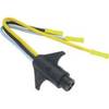
Trailer Wire Adapter 7-Round to 5-Flat Short Lead
-
55-0023 Transom Adaptor - 550012/21/22
-
1852061 MKR-US2-1 Garmin Adapter Cable
-
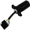
Trolling Motor CONNECTOR, Male, Motor Side #7647-7
-
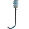
SC110 PowerTower Port Mounted Light Bar W Out Light
-
GPSMAP 546s - Marine GPS receiver - 5" color - 640 x 480
-
GPSMAP 5008 - Marine GPS receiver - 8.4" color - 640 x 480