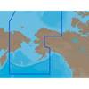
BlueChart g2 Vision - Southeast Florida - Maps
Model: Brand: Garmin
BlueChart g2 Vision offers the same rich detailed charting of BlueChart g2 to help you get the most out of your unit. In addition, g2 Vision features a growing database of high-resolution satellite imagery, above and below the water 3D perspective, auto guidance technology, aerial photographs for real world reference and coastal roads with points of interest. This product features data from explorer charts for the Bahamas! Vero Beach south to include Lake Okeechobee, Florida Keys, Dry Tortugas, and covering the west coast of Florida north to Naples. Also covered all the Bahamas, Andros Island, Eleuthera Island, Cat Island, Great Exuma Island, Little Exuma Island, and Hog Cay. « less
Product Specification
-
General
Product Type: MapsDistribution Media: SD Memory CardFirst Seen On Google Shopping: May 2007 -
Compatibility Information
Designed For: Garmin GPSMAP 4008, 4012, 420, 4208, 420s, 4212, 430, 430s, 430sx, 430x, 440, 440s, 440sx, 440x, 450, 5008, 5012, 520, 5208, 520s, 5212, 525, 525s, 530, 530s, 535, 535s, 540, 540s, 545, 545s, 550, 550s, 555, 555s -
Universal Product Identifiers
Part Numbers: 010-C0711-00, Southeast FloridaGTIN: 00753759068912
Related Products
-
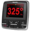
E22166 P70 Autopilot Control Head
-
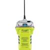
2848.0 Globalfix iPro 406 MHz GPS EPIRB - Category 2
-
080 Marine Navigation Chart Case
-
NA-C804 C-Card Format Northern Alaska
-
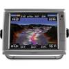
010-00749-01 - GPSMAP 7212, 12 Tchscrn MFD, Coast Map
-
The Nautical Chart [Book]
-
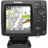
Fishfinder 597ci HD Combo
-
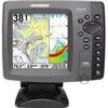
700 Series 788ci Combo CHO - Marine Chartplotter - 5" color - 640 x 640
-
50ft 12AWG CL2 Rated 2-Conductor Loud Speaker Cable (for In-Wall Installation)
-
25ft 16AWG Power Cord Cable w/ 3 Conductor PC Power Connector Socket (C13/5-15P) - Black
-
CONNECTOR, Female Tab 16-14 x .187 25 Per Package
-
Connector Kit for 3/8 Inch LED Rope Light - Imt-ilmdl-conkit-l6