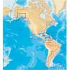
Canada g2 - Maps
Model: Brand: Garmin
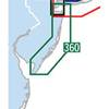
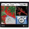
See your surroundings more clearly with BlueChart g2 data. With BlueChart g2, you'll get detailed marine cartography that provides convenient viewing of nautical content. BlueChart g2 allows you to see your vessel's precise, on-chart position in relation to navaids, coastal features, anchorages, obstructions, waterways, restricted areas and more. You also will have access to detailed mapping capabilities that include safety shading, fishing charts, smooth data transition between zoom levels, harmonious transition across chart borders, and reduction of chart discontinuities. « less
Product Specification
-
General
Product Type: MapsFirst Seen On Google Shopping: August 2010 -
Universal Product Identifiers
Part Numbers: 010-C1019-20, Canada g2GTIN: 00753759095758
Related Products
-
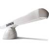
GMR 406 6 ft Open Array Antenna Only
-
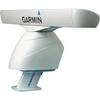
PowerTower 6 Alum Open Array Sitex Simrad Garmin APT6002
-
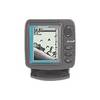
X59 DF - Fishfinder - portable - included transducer : Skimmer
-
Waterproof Chart Kit - New Jersey Coast #WPB0360-02
-
37673 Platinum Plus South Alaska on SD Micro SD
-
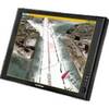
Nauticomp Signature 15 Inch Sunlight Marine Display, Flush Mount
-
Mountable Head Cable Tie 4 Inch 18LBS, 100pcs/Pack - Black
-
15ft 28AWG DisplayPort Cable - White
-
25ft 24AWG Cat6 550mhz UTP Ethernet Bare Copper Network Cable - White
-
000-10294-001 - NSO System w/ 15 Monitor & Keypad
-
Marine Products Plug Wire Set 9-28004
-
Generator PC Control Board 0936420srv