The Sea Chart: The Illustrated History of Nautical Maps and Navigational Charts [Book]
The sea chart was one of the key tools by which ships of trade, transport and conquest navigated their course across the oceans. John Blake looks at the history and development of the chart and the related nautical map, in both scientific and aesthetic terms, as a means of safe and accurate seaborne navigation. This handsome work contains 150 color illustrations including the earliest charts of the Mediterranean made by early thirteenth-century Italian merchant adventurers, as well as eighteenth-century charts that became strategic naval and commercial requirements and led to Cook's voyages in the Pacific, the search for the Northwest Passage, and races to the Arctic and Antarctic. « less
Product Specification
-
Authors: John Blake, Lie LiePages: 160Format: paperbackPublication Date: September 1, 2009
-
Universal Product Identifiers
ISBN: 1591147824GTIN: 09781591147824
Related Products
-
10' Network Cable for Scp Remote Panel 809-0938
-
GRH44 HD Ethernet Radar Open Array 4ft 40382
-
HPWIC3 Map, Wisconsin, Electronic Chart
-
NaM024 CCard Format u.s.west Coast and Hawaii
-
700S-00766 SafeSea E100 EPIRB Category 1 - Auto Release
-
Smartfind Plus G5 GPS EPIRB Automatic Cat I
-
T70007 e7D 7" Multifunction w/Sonar, Internal GPS - Row
-
EC7IF Chartplotter w/Internal Antenna & Fishfinder Tan / Red
-
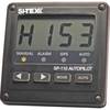
SP110VF-1 Autopilot with Virtual Feedback and No Drive Unit - A
-
Cat6a Ethernet Cable | 1ft | White | Network | 10 Gigabit
-
A3030Y30W Y Adapter - 2 30 Amp 125VAC Connectors -to- 1
-
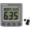
A22009-P ST60 Plus Speed w/Thru Hull Sensor