ChartKit Book w/ Companion CD - Southern and Centra Map
Model: Brand: Maptech
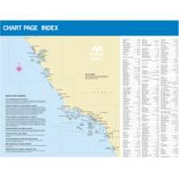
CHARTKIT Book w/ Companion CD Southern and Central California San Francisco to Ensenada, Mexico. Full-color charts, waypoints, courses and distances, marinas, anchorages, chart datums for GPS, and color aerial photos. Save hundreds of dollars on charts. 22 X 17, 71 chart pages. Product Overview New features make ChartKits easy to use with your GPS. Most charts include one-minute lat./long. grids to make vessel positioning a breeze, and major navigation aids are identified with named GPS waypoints. GPS Ready New features make ChartKits easy to use with your GPS. Most charts include one-minute lat./long. grids to make vessel positioning a breeze, and major navigation aids are identified with named GPS waypoints. Small and Large Scale Charts ChartKits include small-scale, wide area charts as well as large-scale, detailed charts of harbors and approaches. The Chart Page Index (inside « less
Product Specification
-
Universal Product Identifiers
Part Number: PAPREGION12
Related Products
-
21118245 RPU300 Hydraulic Pump Drive
-
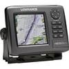
HDS-7 - Marine Chartplotter - 6.4" color - 640 x 480
-
E70014 C127 Multifunction Display w/Sonar - No Preloaded Cha
-
SP0007 Pro Soft Pack Ice Fishing Sonar Cover
-
Pedestal for Gmr404 & 406 Arrays Arrays, 20 1/2"W x 12 3/4"H
-
NT+ - St. Lawrence River and Approaches NA-C202
-
Max AN-M202 W50 Korea Strait, Okinawa Shima-MAX
-
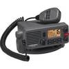
Lvr-250 DSC VHF Fixed-Mount Marine Radio
-
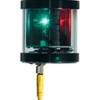
Orca Green Marine LED Tri-Color Anchor / Strobe Navigation Light
-
SP-BL Transom Mount Speed Sensor Blue Connector wspbl
-
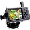
GPSMAP 376C - Marine GPS receiver - 3.8" color - 480 x 320
-
14023 HDS-5m Chart/Gps-No Fishfinder