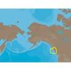
Cuba, Jamaica & The Cayman Islands: NT+ Wide Coverage by C-Map
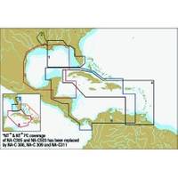
Mfr: C-MAP Electronic Charts - NA-C311; C-Map's Gulf of Mexico & Caribbean Sea NT+ Electronic Charts deliver detailed navigation coverage & information making your voyage safer and more enjoyable no matter what its length. NT+ electronic charts are reverse compatible with NT charting systems but with four times the coverage. C-Map creates their object oriented NT+ charts from official paper charts & adds features paper chart can't match. NT+ charts are object oriented, vector charts faithful reproduced from official paper charts. NT+ charts include all the information from raster & simple vector charts without dilution or any manipulation of chart data or odd scaling. These charts provide seamless coverage allowing smooth panning between coverage layers of any given navigation area. Guardian then signals an alarm when boat enters the area predetermined by the user. NT+ Charts provide tidal information for primary tidal stations worldwide & secondary tidal stations in the U.S. NT+ charts give you North-up or Chart-up view options. The NavAids are presented in detailed, true color paper chart appearance. They are accurate to the best of C-Map's knowledge and any inconsistencies found are generally due to undetectable limitations in the HO charts themselves. Where due, Royalty Charges are included in C-CARD prices and paid to National Hydrographic Authorities. « less
Product Specification
-
Universal Product Identifiers
Part Number: NA-C311
Related Products
-
E12138 SmartPilot X-5 Tiller Grand Prix Corepack - Control H
-
X515c DF 5" Dual Frequency Sonar 123-34
-
10 Inch Power Mount with Ltb Option #PMA-10FJ-7L
-
Ultra Marine Chart Caddy, Teak
-
NA-C703 Furuno FP Format Cape CAUTION - Portland Canal
-
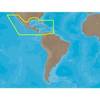
30131 Max - Central America and The Caribbean - C-Card
-
Plans - Howe Sound Chart
-
700S-00766 SafeSea E100 EPIRB Category 1 - Auto Release
-
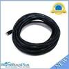
30ft 24AWG Cat6 550mhz UTP Ethernet Bare Copper Network 5017
-
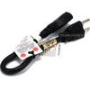
1ft 16AWG Power Cord Cable w/ 3 Conductor PC Power Connector Socket (C13/5-15P) - Black
-
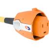
SmartPlug BF30 30 Amp Marine Shore Power Connector
-
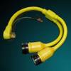
164AY Y Adapter 2-50 Amp Locking to 50 Amp Straight