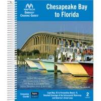
Embassy Cruising Guides - Chesapeake Bay to Florida #BKCBF-02
Model: BKCBF-02 Brand: Maptech
Cape May and Delaware Bay through the Chesapeake and Intracoastal Waterway to Fernandina Beach, FL. Packed with marinas, local navigation advice, aerial photos, and ICW Bridge Table. 560 pages. Use with Chartkit Regions 4 and 6. Product Overview Embassy Guides are the perfect navigation companion when you're planning your trip and underway. They're filled with detailed navigation advice and are an enjoyable read. Maptech offers four guides covering the East Coast of the U.S. from Maine to Florida, plus the Bahamas and Alabama. Designed for Ease of Use Find the information you need quickly. Harbors are indexed by chapters. Marina and facility locations cross-reference quickly with harbor chart segments. Even the crush-proof spiral binding and wrap-around covers are designed for easy page turning and bookmarking. Local Knowledge « less
Product Specification
-
Universal Product Identifiers
Part Number: BKCBF-02
Related Products
-
Chart Master V6i #U1-CHRT-V6i
-
8M0029351 Wireless Sonar Adapter Garmin 6-Pin
-
3G Broadband Radar
-
Marine World Chart of Nicolo de Canerio Januensis 1502 Circa a Critical Study [Book]
-
Lopo Light Masthead (3nm)
-
Trailer Wire Adapter 7-Round to 5-Flat Short Lead
-
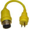
A5030S 125VAC - 50 Amp -to- 125VAC - 30 Amp Straight ad
-
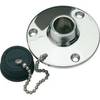
0499DP0CHR Water Inlet Fitting w/Plug
-
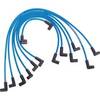
Marine Products Plug Wire Set 9-28019
-
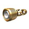
N-Type-Cp/Cs-01 Connector for Rg-58Au Cable
-
White All Round Anchor Light 8 Inch Fixed White
-
Tram 1655 8-ft Marine GPS Antenna