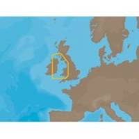
EW-C209 C-Card Format - Irish Sea
Model: EW-C209 Brand: C-Map
Irish Sea: U.K. coverage from Glasgow to Portishead. Ireland coverage from Waterford to Londonderry.
Product Specification
-
Universal Product Identifiers
Part Number: EW-C209C-CARD
Related Products
-
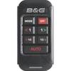
000-10619-001 Triton Pilot Add-on System - High Current
-
SP110VF-5 SP-110 System w/Virtual Feedback & Mechanical Drive U
-
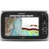
E70022 E97 Multifunction Display W Sonar - No Charts
-
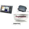
Package(C90W, DSM300G Sounder, 4KW 24 Inch Digital Radome & Radar Cable)
-
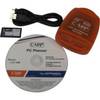
PCPLANNER2 PC Planner - NT+/MAX 2MB
-
Inc MSD/PREM-N6 Map, HotMaps Premium North
-
3206 Lake Mohave
-
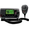
010-00754-00 - VHF 100, Basic, Grey
-
Minding the Helm: Marine Navigation and Piloting [Book]
-
Series 50 Classic Stainless Steel Navigation Lights
-
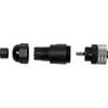
010-11095-00 NMEA 2K Female Connector
-
CRC Marine Electronics Die-Lectic Grease 06106 (3.3 oz.)