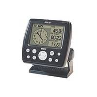
GPS 152 - Marine GPS receiver - 4" monochrome - 100 x 160
Model: 152 Brand: Garmin
The GPS 152 is a 12 parallel channel GPS receiver loaded with a database of American cities and nautical navigation aids such as lights, buoys, sound signals, day beacons and tide data. Built-in memory of one megabyte makes the GPS 152 compatible with Garmin's MapSource Points of Interest CD. With this CD and the GPS 152, you add additional marine navaid detail to your unit. In addition to larger memory, the GPS 152 is compatible with the Wide Area Augmentation System (WAAS), a technology designed to improve the accuracy of GPS positioning to about three meters. On the outside, the GPS 152 comes housed in a waterproof case that's about four inches high and five inches wide. A large four-inch diagonal, high-contrast display features 100x160 pixels for the ultimate in readability. A simple keypad at the bottom of the unit makes entering information easy, without blocking your view of the display. « less
Product Specification
-
General
Product Type: GPS receiverRecommended Use: MarinePreloaded Maps: North America, South AmericaReceiver: 12 channelInterface: Serial, NMEA 0183, RTCM SC-104 DGPSFunctions & Services: Tide Tab, elevation, MOB (Man Overboard), heading, ETA (Estimated Time of Arrival), XTE (Cross Track Error), VMG (Velocity Made Good), speed, time/dateCompatible Software: MapSource Points of InterestGrids: UTM, MGRS, Lat/Lon, UPS, Loran TDs, Maidenhead, QatarSBAS: WAASDGPS: DGPS readyAntenna: ExternalAccuracy: Position - 49 ft Velocity - 0.16 ft/sec Position - 10 ft ( with WAAS ) Position - 10 ft - 16 ft ( with DGPS )Update Rate: 1/secondInternal Memory: 1 MB flashFirst Seen On Google Shopping: November 2001 -
Display
Type: LCD - monochromeDiagonal Size: 4"Resolution: 100 x 160Display Illumination: Yes -
Acquisition Times
Warm: 15 secCold: 45 sec -
Navigation
Waypoints: 500Tracklog Points: 2048Routes: 20Waypoints per route: 30Trip Computer: TracBack, average speed, maximum speed, trip timer, trip distance, sunrise/sunset times -
Miscellaneous
Protection: WaterproofWaterproof Standard: IPX7Included Accessories: PC cable, mounting bracketLocalization: English -
Dimensions & Weight
Width: 5.3 inDepth: 2.4 inHeight: 4.9 inWeight: 16 oz -
Manufacturer Warranty
Service & Support: 1 year warranty -
Environmental Parameters
Min Operating Temperature: 5 °FMax Operating Temperature: 158 °F -
Universal Product Identifiers
Part Numbers: 010-00227-00, 010-00227-10, 152GTIN: 00753759028145, 00753759085421
Related Products
-
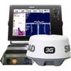
NSS12 Navigation Pack - NSS12, 3G Radar BSM-1
-
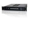
Marinenav Explorer Marine Navigation PC Computer EXP-013-AMD
-
8265; Map-Lake Camanche/Folsom Lake
-
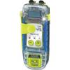
2884 - AquaLink View PLB, GPS Strobe 32hr, Disp
-
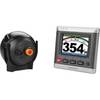
GHP20 Marine Autopilot System for Steer-by-Wire 010-00705-55
-
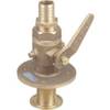
0835006PLB Seacock w/Straight TP 1in
-
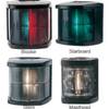
Marine Navigation Lights for Boats to 65'7" Masthead Series
-
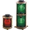
70M Double 360 Degree Green Navigation Light
-
Double Lens, 360� Navigation Lights, 120V Volts, White
-
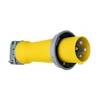
Wiring Device-Kellems M4100P12 Plug, Pin/Sleeve, 100 A
-
TNC-Cp/Gs-02 Connector for RG-8X Cable tncpgs
-
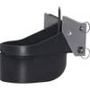
TM258-8F 1kW 50/200 kHz Transom Mount Transducer 8F Connector