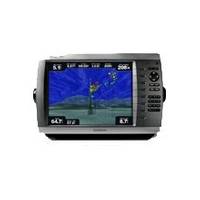
GPSMAP 4012 - Marine GPS receiver - 10.4" color - 800 x 600
Model: 4012 Brand: Garmin
The power of networking meets the brilliance of great design in this large-screen chartplotter, which serves as your all-in-one "nerve center" for the Garmin Marine Network. The GPSMAP 4012 has crisp, video-quality resolution on a large 12" (30.7 cm) XGA display as well as a worldwide, satellite-enhanced basemap. By connecting to the Garmin Marine Network, you can add sonar and radar. The 4012 features a worldwide basemap with high-quality satellite images in place of more traditional maps. And for more detail, you can add maps easily with the Sd card slot without having to connect to a computer. The 4012's high-speed processor draws maps quickly, and its simple intuitive interface makes navigating easy. To keep tabs on your engine room or other area of your boat, you also can connect a live video feed with the 4012's video input and output options. « less
Product Specification
-
General
Product Type: GPS receiverRecommended Use: MarineCard Reader: SD Memory CardInterface: NMEA 0183, NMEA 2000Included Software: Garmin Worldwide Marine BasemapCompatible Software: BlueChart g2 VisionSBAS: WAASAntenna: ExternalFeatures: Optional external GPS antenna connection, alarm, 2D / 3D map perspectiveFirst Seen On Google Shopping: June 2009 -
Display
Type: TFT - colorDiagonal Size: 10.4"Resolution: 800 x 600 -
Navigation
Waypoints: 1500Tracks: 20Tracklog Points: 10000Routes: 20Trip Computer: Sunrise/sunset times, sun/moon positions -
Connections
Interfaces: Garmin Marine Network -
Miscellaneous
Protection: WaterproofWaterproof Standard: IPX7Included Accessories: Protective cover, PC cable, mounting bracket, power cable -
Dimensions & Weight
Width: 13.4 inDepth: 4.2 inHeight: 8.9 inWeight: 7.7 lbs -
Universal Product Identifiers
Part Numbers: 010-00690-00, 4012GTIN: 00753759076030
Related Products
-
p70R & X-10 Corepack & Type 1 Pumpset Autopilot Package for Hydraulic Steered Powerboats T70079 c44130
-
E Series: E80/E120 Radar [DVD]
-
JMA-5322-9 Radar 96 NM with 9' Open Array & 19 Inch LCD Monitor
-
492/50/200ST-ES Ducer F/ EC5F EC7F ES502
-
AN-M203 C-Card Format Yellow Sea & Malaya
-
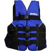
LJ-SMED - Adult Life Vest Size Small/Medium
-
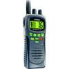
T42554 Atlantis Hand-Held VHF 2-Way Marine Radio - Black
-
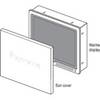
Suncovers for G Series Marine Displays G190 9717661
-
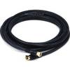
12ft RG6 (18AWG) 75OHM, Quad Shield, CL2 Coaxial Cable with F Type Connector - Black
-
1.5ft Premium 2.5mm Stereo Male to 2rca Male 22AWG Cable
-
GPSMAP 421s - Marine Chartplotter - 4" color - 240 x 320
-
SS264W - 50kHz - 20 Deg - 6 Pin Garmin Connector