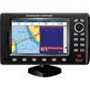
GPSMAP 5012 - Marine GPS receiver - 12.1" color - 1024 x 768
Model: 5012 Brand: Garmin
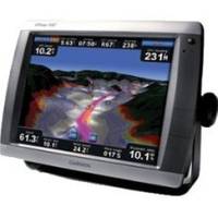
This flagship marine navigator is missing just one thing - buttons. The GPSMAP 5012 features an unprecedented touchscreen interface, along with a satellite-enhanced worldwide basemap and a whopping 12.1" screen that makes navigation as easy as pointing your finger. By connecting to the Garmin Marine Network, you can add sonar, radar and weather. The GPSMAP 5012 features a worldwide basemap with high-quality satellite images in place of more traditional maps. For even more detail, you can add maps easily with the SD card slot without having to connect to a computer. The 5012's huge XGA screen displays graphics with crisp, video-quality resolution. To keep tabs on your engine room or other area of your boat, you can also connect a live video feed with the 5012's video input/output options. The 5012 connects easily to the high-speed Garmin Marine Network, so you can interface with additional MFDs and add remote sensors. Once connected, you can share information between the 5012 and other chartplotters on your boat. You can also add high-powered radar, sonar, and XM satellite weather and radio to your system. This product is bundled with GPS 17 with pole mount adapter. « less
Product Specification
-
General
Product Type: GPS receiverRecommended Use: MarineCard Reader: SD Memory CardInterface: NMEA 0183, NMEA 2000Included Software: Garmin Worldwide Marine BasemapCompatible Software: BlueChart g2 VisionSBAS: WAASAntenna: ExternalFeatures: Alarm, 2D / 3D map perspectiveFirst Seen On Google Shopping: April 2007 -
Display
Type: TFT - color - touch screenDiagonal Size: 12.1"Resolution: 1024 x 768 -
Navigation
Waypoints: 1500Tracks: 20Tracklog Points: 10000Routes: 20Trip Computer: Sunrise/sunset times, sun/moon positions -
Connections
Interfaces: Garmin Marine Network Composite video input -
Miscellaneous
Protection: WaterproofWaterproof Standard: IPX7Included Accessories: Protective cover, PC cable, mounting bracket, power cable -
Dimensions & Weight
Width: 13 inDepth: 4.7 inHeight: 9.5 inWeight: 9.5 lbs -
Universal Product Identifiers
Part Numbers: 010-00594-00, 5012GTIN: 00007537590660, 00753759066093, 00999999770455
Related Products
-
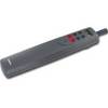
Tiller Autopilot St-1000+ A12004
-
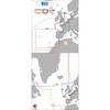
Max EN-M405 W27 Greenland Coasts-MAX
-
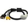
010-11091-00 Marine Audio/Video Cable, Right Angle
-
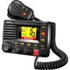
UM625C-BK VHF Marine Two-Way Radio Black
-
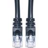
Cat6a Ethernet Cable | 1ft | Black | Network | 10 Gigabit
-
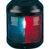
Navigation Light for Bulk Head Mounting Bi Color
-
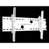
Adjustable Tilting Wall Mount Bracket for LCD LED Plasma (Max 165Lbs, 30~63inch) - White
-
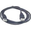
6ft USB 2.0 A Male to A Female Extension 28/24AWG Cable (Gold Plated)
-
Serial extension cable - (DB-9) - F - (DB-9) - M - 10 ft - PC
-
Marine -3899-3 St CONNECTOR-THREAD to 3/4 Barb
-
CrossoverGPS 2500T - Marine, hiking, automotive GPS receiver - 3.5" color
-
7" GPS CHARTPLOTTER/FF W/MAPS