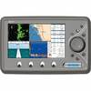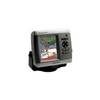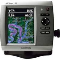
GPSMAP 536 - Marine Chartplotter - 5" color - 480 x 640
Model: 536 Brand: Garmin
The GPSMAP 536 is a compact chartplotter that features a high-resolution, super-bright 5" VGA color display along with an improved high-speed digital design for increased map drawing and panning speeds. It's ready to go with a built-in, satellite-enhanced basemap and an easy-to-use interface designed to help you navigate the open waters with ease. The GPSMAP 536 also accepts BlueChart g2 Vision cards for added features and functionality such as high-resolution satellite imagery, 3-D views and Auto Guidance technology. The GPSMAP 536 has a worldwide basemap with satellite images in place of more traditional maps. The GPSMAP 536 also comes standard with a high-sensitivity GPS receiver for superior satellite tracking and quicker acquisition times. With an SD card slot, it's easy to add additional maps without connecting to a computer. The GPSMAP 536 is also NMEA 2000-certified for easy connectivity with sensors, instruments and future marine offerings. « less
Product Specification
-
General
Product Type: ChartplotterRecommended Use: MarineCard Reader: SD Memory CardInterface: NMEA 0183, NMEA 2000Functions & Services: Tide TabIncluded Software: MapSource BlueChart Inland Lakes: United StatesCompatible Software: BlueChart g2 VisionFeatures: Optional external GPS antenna connection, XM weather supportFirst Seen On Google Shopping: February 2011 -
Display
Type: LCD - colorDiagonal Size: 5"Resolution: 480 x 640 -
Navigation
Waypoints: 3000Tracks: 50Tracklog Points: 20000Routes: 100Trip Computer: Sun/moon positions -
Miscellaneous
Protection: WaterproofWaterproof Standard: IPX7Included Accessories: Protective cover, mounting bracket, power/data cable -
Dimensions & Weight
Width: 5.9 inDepth: 2.9 inHeight: 6.4 inWeight: 1.8 lbs -
Universal Product Identifiers
Part Numbers: 010-00773-00, 536GTIN: 00753759096137
Related Products
-
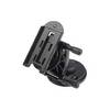
Marine Mount - GPS receiver mount bracket
-
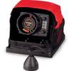
LX-5 Dual Beam True Color Sonar Flasher System
-
Marine World Chart of Nicolo de Canerio Januensis, Circa 1502: A Critical Study (1908) [Book]
-
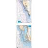
Waterproof Charts 15F Southwest Florida FISH/DIVE
-
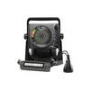
ICE 35 - Fishfinder - portable - included transducer : XI 9 19 - dual-beam
-
Norwood's Epitomie: Or the Application of the Doctrine of Triangles in Certaine Problemes, to the Use of the Plaine Sea-Chart, and Mercators-Chart Being the Two Principall and Most Usefull Kinds of Sayling. (1645) [Book]
-
EC7I 7 Inch Color Plotter with Internal GPS
-
Cable Ci 14-2 W PB500 Contractor 14-Gauge Speaker
-
Marine Remote Control Y Connector - MS-WR100Y - MS-WR100Y
-
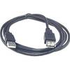
6ft USB 2.0 A Male to A Female Extension 28/24AWG Cable (Gold Plated)
-
Marine -033485-10 Fuel CONN-FEMALE Mer (240090)
-
GPSMAP 430s Marine GPS Navigation System Dual Beam Transom Transducer