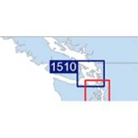
Waterproof Chart Kit - San Juan Islands #WPB1510-02
Model: WPB1510-02 Brand: Maptech
Waterproof Charts w/ Companion CD WPB1510 1510: San Juan Islands Whidbey Island and Bellingham to Boundary Pass. 23 pages of charts, 130 GPS waypoints, Lat. /Long. grids, courses, ramps, and marine facilities. Overview and detailed pass and harbor charts. 12 x 17, scales 1:200,000 to 1:20,000 Product Overview These easy-to-use, compact chart books are ideal for Day-Sailors, Fishing Boats, and Trailer Boats. They measure 12 x 17 (24 x 17 when open) and are made of waterproof, tear-resistant synthetic paper that will withstand the elements. GPS Ready New features make Waterproof Chartbooks easy to use with your GPS. Most charts include one-minute lat./long. grids to make vessel positioning a breeze, and major navigation aids are identified with named GPS waypoints. Small and Large-Scale Charts Waterproof Chartbooks include small-scale, wide area charts as well as large-scale, detailed charts of ha « less
Product Specification
-
Universal Product Identifiers
Part Number: WPB1510-02
Related Products
-
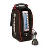
Showdown 5.6 Dual Beam Digital Fishfinder
-
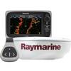
e7D 7" Multifunction Display with Sonar, Internal GPS, USA Inland Charts, RD418D Radar & No Transducer T70106 c44596
-
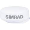
Dx42s1 18 2KW Radar Dome Wprocessor and 15m Cbl
-
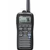
M92D Floating Handheld VHF Marine Radio
-
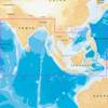
31XG/CF Indian Ocean and South China Sea Gold
-
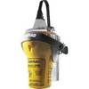
EPIRB Auto Release Cat I, No GPS EP50 Auto c30589
-
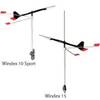
3120 Windex 10 Sport Wind Indicator
-
2832 35ft Optical Toslink 5.0mm OD Audio Cable
-
3ft 28AWG High Speed HDMI Cable w/Ferrite cores - Green
-
Cable Tie 4 Inch 18LBS, 100pcs/Pack - Blue
-
FA-CF-90 - Field CONNECTOR, Female Micro/Mid, 90?
-
1ft 24AWG Cat5e 350MHz UTP Bare Copper Ethernet Network Cable - Red