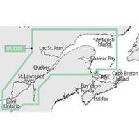
NT+ - St. Lawrence River and Approaches NA-C202
Model: NA-C202 Brand: C-Map
C-MAP has set the standard for electronic charts with five consecutive NMEA awards for "Best Electronic Cartography". The spring 2004 C-MAP NT+ release will include marina detail for over 1,000 US marinas in C-MAPs private collection. Now you will be able to see slip detail as well as the locations for onshore facilities. Finding the right chart plotter for you is easy with 17 manufacturers powered by C-MAP. Just look for the NT+ logo. « less
Product Specification
-
Universal Product Identifiers
Part Number: NA-C202GTIN: 00686074003781
Related Products
-
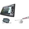
Package(E140W, GPS Antenna, DSM300G Sounder, RA1072HD 4KW 72 Inch HD Digital Open Array Radar & 15m Radar Cable )
-
010-C0772-10 Bluechart G2 HEU014RItaly Adriatic Sea Data Card
-
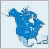
City Navigator North America NT 2012 Map Card Microsd/sd 010-11551-00 c38854
-
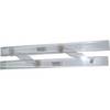
061 15 Parallel Rules
-
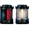
Series 55 Commercial Navigation Lights, Series 55 Stern Light White
-
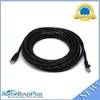
Cat6a Ethernet Cable | 15ft | Gray | Network | 10 Gigabit
-
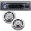
PKG-MR333 - Marine In-Dash Stereo & 6.5" 2-Way Speakers
-
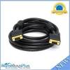
VGA Male to Male Cable 15 ft. CL2
-
20ft 24AWG Cat6 550mhz UTP Ethernet Bare Copper Network Cable - Black
-
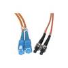
Network cable - 2 x SC MM - M - 2 x ST MM - M - Fiber optic 16.4 ft
-
MMC-00821 Small Water Tight Connector
-
700 Series 785c2i NVB - Marine Chartplotter - 5" color - 480 x 640