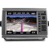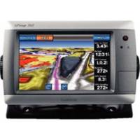
GPSMAP 740 GPS Chartplotter with Internal GPS Antenna 010-00835-02
Model: 010-00835-02 Brand: Garmin
These stand-alone touchscreen chartplotters feature a brilliant 7" color display and includes an internal high-sensitivity GPS receiver for superior satellite tracking and quicker acquisition times. The intuitive touchscreen interface makes operation simple and the widescreen display is waterproof and built to last. With a built-in radar port it is easy to add one of the GMR marine radar systems. Addition of the GXM 51 antenna enables graphical weather data for North America & XM satellite radio. Other features include AIS support DSC position display audible alarms tide tables sun & moon informationa NMEA 0183 & 2000 interface and more. 3000 Waypoints 100 routes 20000 points 50 saved tracks. Standard models are GPS/Chartplotters and do not include sonar capability. S models include a powerful dual frequency 200/50kHz sonar transceiver to help you define fish and underwater structures as deep as 2000' when used with a 1kW transducer. Transducers sold separately. 720/720s include a worldwide basemap. 740/740s include the basemap plus U.S. Coastal maps including Alaska & Hawaii as well as detailed Bahamas charts. « less
Product Specification
-
Universal Product Identifiers
Part Number: 100083502
Related Products
-
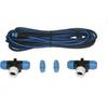
T16012 - SeaTalk NG > X-Series A/P Backbone Kit
-
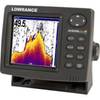
X515c DF 5" Dual Frequency Sonar 123-34
-
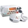
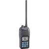
Mr F55 Marine Fixed Mount VHF 25 watt, White
-
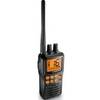
kv8715 Floating VHF Marine Radio
-
010-00751-01 - GPSMAP 6212, 12 MFD, Coastal Map
-
T70056 E125 Multifunction Display w/US Inland Charts
-
SmartCast RF35 - Fishfinder - portable - included transducer : RF45 - single-beam
-
Accuform Signs MLMR128GE NOTICE Sign, 6 x 6In, GRN/Glow Wht, SYM, IMO
-
Lopo Light Single Stb Vessel Size 40
-
Powerboat Navigation Light, All Round Plug In, 48"
-
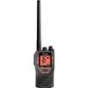
M24 Handheld VHF Radio cw-41172
-
Marine Radio Two Way VHF