MapSource BlueChart - Inland Rivers - Maps
Model: Brand: Garmin
MapSource BlueChart is Garmin's exclusive marine cartography and was developed to provide you with mapping flexibility and options you've never had before. This line of cartography products is designed to provide interactive viewing of detailed nautical chart data, thereby providing navigators with innovative object-oriented cartography. These detailed electronic nautical charts look just like paper charts when displayed on your Garmin chartplotter. Features include shading between depth contours, spot soundings, navaids, port plans, wrecks, obstructions, inter-tidal zones, and more. BlueChart offers much larger coverage areas for half the price. MapSource BlueChart Inland Rivers provides detailed main channel coverage of the major rivers of the interior of the United States. It includes the Ohio, Illinois and the Atchafalaya Rivers in their entirety, and the Mississippi River from its junction with the Illinois above St. Louis, MO to the Delta. It also includes the Tennessee River from Knoxville, TN to the Ohio; the Cumberland River from Celina, TN to the Ohio; and the Red River from Shreveport, LA to the Mississippi. It also provides general coverage of the Gulf of Mexico from Port Arthur, TX to Biloxi, MS; and the southern portion of Lake Michigan from Waukegan, IL to South Haven, MI. « less
Product Specification
-
General
Product Type: MapsDistribution Media: Garmin Data CardFirst Seen On Google Shopping: January 2006 -
Compatibility Information
Designed For: Garmin GPSMap 172C, 176, 176C, 178C, 178C Sounder, 182, 182C, 188 Sounder, 188C Sounder, 196, 2006, 2006C, 2010, 2010C, 2106C, 2110C, 2206C, 2210C, 232, 238 Sounder, 276C, 292C, 296, 298C, 3006C, 3010c, 3205C, 3206C, 3210C, 376C, 392C, 396C, 492C, 498C -
Universal Product Identifiers
Part Numbers: 010-C0487-00, Inland RiversGTIN: 00753759057282
Related Products
-
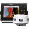
NSS7 Navigation Pack - NSS7 & 3G Radar 000-10629-001
-
FBRS 2742 Battery Service Include 1098.1 Bat Parts Labor
-
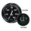
Gauges 12821 Euro Voltmeter 10-16v for Al
-
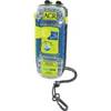
ACR2882 ACR AquaLink PLB350B
-
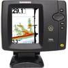
500 Series 596c - Fishfinder - included transducer : XNT-9-20-T - dual-beam
-
010-00705-30 - GHP 12 Autopilot Corepack
-
1-1 4 in. IPS Intake Strainer Bronze Made in The USA
-
30ft 24AWG Cat5e 350MHz UTP Bare Copper Ethernet Network Cable - Orange
-
6ft 28AWG High Speed HDMI Cable w/Ferrite cores - Red
-
10ft USB 2.0 A Male to A Female Extension 28/24AWG Cable (Gold Plated)
-
Patch cable - CAT 6 - RJ-45 - M - Unshielded twisted pair (UTP) 7 ft - Gray
-
AS-USB Serial to USB Adapter 760018-1